

From Montreal to Sainte-Agathe-des-Monts
A cycling route starting in Saint-Laurent, Quebec, Canada.
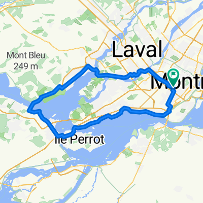
Overview
About this route
- 6 h 48 min
- Duration
- 112.2 km
- Distance
- 652 m
- Ascent
- 320 m
- Descent
- 16.5 km/h
- Avg. speed
- 389 m
- Max. altitude

Route quality
Waytypes & surfaces along the route
Waytypes
Cycleway
93.1 km
(83 %)
Quiet road
13.5 km
(12 %)
Surfaces
Paved
74.1 km
(66 %)
Unpaved
34.8 km
(31 %)
Asphalt
74.1 km
(66 %)
Gravel
31.4 km
(28 %)
Continue with Bikemap
Use, edit, or download this cycling route
You would like to ride From Montreal to Sainte-Agathe-des-Monts or customize it for your own trip? Here is what you can do with this Bikemap route:
Free features
- Save this route as favorite or in collections
- Copy & plan your own version of this route
- Split it into stages to create a multi-day tour
- Sync your route with Garmin or Wahoo
Premium features
Free trial for 3 days, or one-time payment. More about Bikemap Premium.
- Navigate this route on iOS & Android
- Export a GPX / KML file of this route
- Create your custom printout (try it for free)
- Download this route for offline navigation
Discover more Premium features.
Get Bikemap PremiumFrom our community
Other popular routes starting in Saint-Laurent
 MTL Tour 2021
- Distance
- 129.3 km
- Ascent
- 62 m
- Descent
- 64 m
- Location
- Saint-Laurent, Quebec, Canada
 Rue des Équinoxes 2464, Montréal to Rue des Équinoxes 2475, Montréal
- Distance
- 42.1 km
- Ascent
- 109 m
- Descent
- 109 m
- Location
- Saint-Laurent, Quebec, Canada
 Moderate route in Montréal
- Distance
- 16.8 km
- Ascent
- 99 m
- Descent
- 121 m
- Location
- Saint-Laurent, Quebec, Canada
 bois franc to pont viau
- Distance
- 18.5 km
- Ascent
- 2,337 m
- Descent
- 2,338 m
- Location
- Saint-Laurent, Quebec, Canada
 Route stable en
- Distance
- 58.1 km
- Ascent
- 196 m
- Descent
- 198 m
- Location
- Saint-Laurent, Quebec, Canada
 Saint-Laurent to Polytechnique
- Distance
- 8.6 km
- Ascent
- 95 m
- Descent
- 5 m
- Location
- Saint-Laurent, Quebec, Canada
 4640 Av Bourret, Montréal to 4640 Av Bourret, Montréal
- Distance
- 103.7 km
- Ascent
- 361 m
- Descent
- 362 m
- Location
- Saint-Laurent, Quebec, Canada
 DVS_20130711A
- Distance
- 54.7 km
- Ascent
- 74 m
- Descent
- 78 m
- Location
- Saint-Laurent, Quebec, Canada
Open it in the app