

Cañon de la Sierra a Casa
A cycling route starting in Bosques de San Pedro, Nuevo León, Mexico.
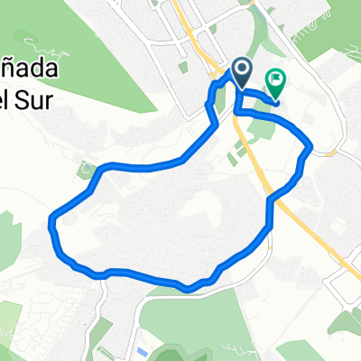
Overview
About this route
- 30 min
- Duration
- 9 km
- Distance
- 59 m
- Ascent
- 42 m
- Descent
- 17.9 km/h
- Avg. speed
- 609 m
- Max. altitude

Route quality
Waytypes & surfaces along the route
Waytypes
Road
7.3 km
(82 %)
Quiet road
1.6 km
(18 %)
Surfaces
Paved
1.9 km
(21 %)
Asphalt
1.6 km
(18 %)
Paved (undefined)
0.3 km
(3 %)
Undefined
7.1 km
(79 %)
Continue with Bikemap
Use, edit, or download this cycling route
You would like to ride Cañon de la Sierra a Casa or customize it for your own trip? Here is what you can do with this Bikemap route:
Free features
- Save this route as favorite or in collections
- Copy & plan your own version of this route
- Sync your route with Garmin or Wahoo
Premium features
Free trial for 3 days, or one-time payment. More about Bikemap Premium.
- Navigate this route on iOS & Android
- Export a GPX / KML file of this route
- Create your custom printout (try it for free)
- Download this route for offline navigation
Discover more Premium features.
Get Bikemap PremiumFrom our community
Other popular routes starting in Bosques de San Pedro
 De Avenida Sierra Alta, Monterrey a Avenida Sierra Alta, Monterrey
- Distance
- 16.8 km
- Ascent
- 446 m
- Descent
- 446 m
- Location
- Bosques de San Pedro, Nuevo León, Mexico
 Paseo lento en Monterrey
- Distance
- 10.2 km
- Ascent
- 67 m
- Descent
- 68 m
- Location
- Bosques de San Pedro, Nuevo León, Mexico
 Carretera a Alfonso Reyes
- Distance
- 6.3 km
- Ascent
- 45 m
- Descent
- 39 m
- Location
- Bosques de San Pedro, Nuevo León, Mexico
 Cañon de la Sierra a Casa
- Distance
- 9 km
- Ascent
- 59 m
- Descent
- 42 m
- Location
- Bosques de San Pedro, Nuevo León, Mexico
 el barro - las adjuntas
- Distance
- 36.8 km
- Ascent
- 680 m
- Descent
- 488 m
- Location
- Bosques de San Pedro, Nuevo León, Mexico
 Sierra Alta
- Distance
- 8.9 km
- Ascent
- 89 m
- Descent
- 91 m
- Location
- Bosques de San Pedro, Nuevo León, Mexico
 nueva subida barrial
- Distance
- 14.9 km
- Ascent
- 210 m
- Descent
- 98 m
- Location
- Bosques de San Pedro, Nuevo León, Mexico
 De Carretera a Montebello, Juárez a Calle Ocre 212, Guadalupe
- Distance
- 10.1 km
- Ascent
- 17 m
- Descent
- 131 m
- Location
- Bosques de San Pedro, Nuevo León, Mexico
Open it in the app