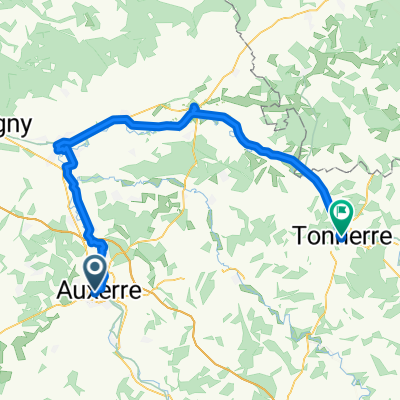
Route to Commelle-Vernay
A cycling route starting in Auxerre, Bourgogne-Franche-Comté, France.
Overview
About this route
- 23 h 40 min
- Duration
- 404 km
- Distance
- 1,446 m
- Ascent
- 1,445 m
- Descent
- 17.1 km/h
- Avg. speed
- 286 m
- Avg. speed
Route quality
Waytypes & surfaces along the route
Waytypes
Cycleway
216.8 km
(54 %)
Quiet road
98.8 km
(24 %)
Surfaces
Paved
296 km
(73 %)
Unpaved
17.3 km
(4 %)
Asphalt
277.3 km
(69 %)
Gravel
16.5 km
(4 %)
Continue with Bikemap
Use, edit, or download this cycling route
You would like to ride Route to Commelle-Vernay or customize it for your own trip? Here is what you can do with this Bikemap route:
Free features
- Save this route as favorite or in collections
- Copy & plan your own version of this route
- Sync your route with Garmin or Wahoo
Premium features
Free trial for 3 days, or one-time payment. More about Bikemap Premium.
- Navigate this route on iOS & Android
- Export a GPX / KML file of this route
- Create your custom printout (try it for free)
- Download this route for offline navigation
Discover more Premium features.
Get Bikemap PremiumFrom our community
Other popular routes starting in Auxerre
- Auxerre - Nevers
- Distance
- 213.5 km
- Ascent
- 678 m
- Descent
- 600 m
- Location
- Auxerre, Bourgogne-Franche-Comté, France
- Canal du Nivernais with POI
- Distance
- 183.2 km
- Ascent
- 331 m
- Descent
- 237 m
- Location
- Auxerre, Bourgogne-Franche-Comté, France
- Bourgogne Loire Seine Yonne
- Distance
- 715.3 km
- Ascent
- 1,893 m
- Descent
- 1,893 m
- Location
- Auxerre, Bourgogne-Franche-Comté, France
- Route to Commelle-Vernay
- Distance
- 404 km
- Ascent
- 1,446 m
- Descent
- 1,445 m
- Location
- Auxerre, Bourgogne-Franche-Comté, France
- auxerre-clamecy
- Distance
- 64.2 km
- Ascent
- 120 m
- Descent
- 95 m
- Location
- Auxerre, Bourgogne-Franche-Comté, France
- Girolibero: Il Canale di Borgogna e del Nivernais
- Distance
- 257.3 km
- Ascent
- 1,120 m
- Descent
- 995 m
- Location
- Auxerre, Bourgogne-Franche-Comté, France
- Burgund - Auxerre - Yonne - Canal de Nivernais
- Distance
- 49.7 km
- Ascent
- 389 m
- Descent
- 348 m
- Location
- Auxerre, Bourgogne-Franche-Comté, France
- Parcours Casse-pattes dans le Chablisien
- Distance
- 76 km
- Ascent
- 861 m
- Descent
- 859 m
- Location
- Auxerre, Bourgogne-Franche-Comté, France
Open it in the app