

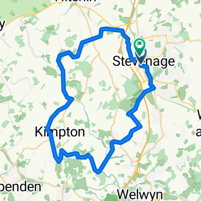
Symonds Green -Langley-st Paul’s Walden-st Ippolyts look
A cycling route starting in Stevenage, England, United Kingdom.
Overview
About this route
- 1 h 10 min
- Duration
- 19.3 km
- Distance
- 162 m
- Ascent
- 158 m
- Descent
- 16.7 km/h
- Avg. speed
- 158 m
- Max. altitude
Route photos


Route quality
Waytypes & surfaces along the route
Waytypes
Quiet road
8.1 km
(42 %)
Road
4.4 km
(23 %)
Surfaces
Paved
15.5 km
(80 %)
Unpaved
2.7 km
(14 %)
Asphalt
14.3 km
(74 %)
Ground
1.5 km
(8 %)
Continue with Bikemap
Use, edit, or download this cycling route
You would like to ride Symonds Green -Langley-st Paul’s Walden-st Ippolyts look or customize it for your own trip? Here is what you can do with this Bikemap route:
Free features
- Save this route as favorite or in collections
- Copy & plan your own version of this route
- Sync your route with Garmin or Wahoo
Premium features
Free trial for 3 days, or one-time payment. More about Bikemap Premium.
- Navigate this route on iOS & Android
- Export a GPX / KML file of this route
- Create your custom printout (try it for free)
- Download this route for offline navigation
Discover more Premium features.
Get Bikemap PremiumFrom our community
Other popular routes starting in Stevenage
 Route in Stevenage
- Distance
- 47.3 km
- Ascent
- 404 m
- Descent
- 408 m
- Location
- Stevenage, England, United Kingdom
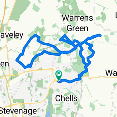
 steady ride Stevenage
- Distance
- 18.2 km
- Ascent
- 283 m
- Descent
- 283 m
- Location
- Stevenage, England, United Kingdom
 first ride
- Distance
- 16.7 km
- Ascent
- 159 m
- Descent
- 159 m
- Location
- Stevenage, England, United Kingdom
 15 miles via St Ippolyts
- Distance
- 24.8 km
- Ascent
- 137 m
- Descent
- 138 m
- Location
- Stevenage, England, United Kingdom
- Symonds Green -Langley-st Paul’s Walden-st Ippolyts look
- Distance
- 19.3 km
- Ascent
- 162 m
- Descent
- 158 m
- Location
- Stevenage, England, United Kingdom
 Route to London Road 19, Langley
- Distance
- 40.2 km
- Ascent
- 483 m
- Descent
- 485 m
- Location
- Stevenage, England, United Kingdom
 Restful route
- Distance
- 52.5 km
- Ascent
- 598 m
- Descent
- 635 m
- Location
- Stevenage, England, United Kingdom
 Fawcett Road to Fawcett Road
- Distance
- 21.1 km
- Ascent
- 292 m
- Descent
- 332 m
- Location
- Stevenage, England, United Kingdom
Open it in the app