Erlebnistour 2: Durchs Brehmbachtal zum Hohen Herrgott
- 58.7 km
- 540 m
- 541 m
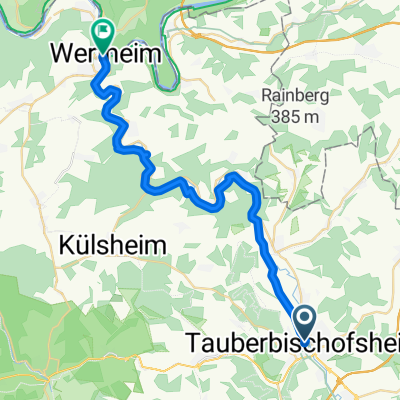
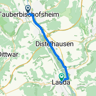
- Tauberbischofsheim, Baden-Wurttemberg, Germany
A cycling route starting in Tauberbischofsheim, Baden-Wurttemberg, Germany.
Overview
x times almost every year so 20 times back and forth guaranteed! One of the most beautiful cycling routes in Germany all asphalt mostly away from the roads everywhere fruit orchards...romantic little towns, a great river for swimming, and Riemenschneider altars everywhere anyone who doesn’t know Rothenburg must of course go there! even if it's Disneyland because everything was in rubble during the war...and was rebuilt with the money of the romance-obsessed Americans.
created this 16 years ago
Route quality
Track
33.5 km
(44 %)
Quiet road
23.6 km
(31 %)
Paved
61.6 km
(81 %)
Unpaved
3.8 km
(5 %)
Asphalt
57.8 km
(76 %)
Paved (undefined)
3.8 km
(5 %)
Route highlights
Wasser,Fiedhof
Ü Platz unter Obstbäumen,direkt am Wasser
Supermarkt
Wasser
Ü Platz an Schandtauber,sauberes Wasser zum Baden
Ü Platz,vor der Wasserscheide
Continue with Bikemap
You would like to ride 1993-2010 Taubertal Radweg or customize it for your own trip? Here is what you can do with this Bikemap route:
Free trial for 3 days, or one-time payment. More about Bikemap Premium.
Discover more Premium features.
Get Bikemap PremiumFrom our community
Open it in the app