

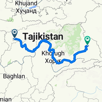
Pamir Highway
A cycling route starting in Dushanbe, Dushanbe, Tajikistan.
Overview
About this route
- 90 h 22 min
- Duration
- 1,382.1 km
- Distance
- 16,138 m
- Ascent
- 15,972 m
- Descent
- 15.3 km/h
- Avg. speed
- 4,654 m
- Max. altitude

Continue with Bikemap
Use, edit, or download this cycling route
You would like to ride Pamir Highway or customize it for your own trip? Here is what you can do with this Bikemap route:
Free features
- Save this route as favorite or in collections
- Copy & plan your own version of this route
- Split it into stages to create a multi-day tour
- Sync your route with Garmin or Wahoo
Premium features
Free trial for 3 days, or one-time payment. More about Bikemap Premium.
- Navigate this route on iOS & Android
- Export a GPX / KML file of this route
- Create your custom printout (try it for free)
- Download this route for offline navigation
Discover more Premium features.
Get Bikemap PremiumFrom our community
Other popular routes starting in Dushanbe
 Day 36 u 37 u 38 u 39
- Distance
- 88.6 km
- Ascent
- 234 m
- Descent
- 468 m
- Location
- Dushanbe, Dushanbe, Tajikistan
 От кӯчаи Айни, Душанбе до кӯчаи Алишер Навоӣ 30, Душанбе
- Distance
- 17.5 km
- Ascent
- 364 m
- Descent
- 229 m
- Location
- Dushanbe, Dushanbe, Tajikistan
 Leg 7 - Dushanbe to Murghab
- Distance
- 963.8 km
- Ascent
- 6,888 m
- Descent
- 4,106 m
- Location
- Dushanbe, Dushanbe, Tajikistan
 Dushanbe - Kulma Pass
- Distance
- 994.6 km
- Ascent
- 7,033 m
- Descent
- 3,481 m
- Location
- Dushanbe, Dushanbe, Tajikistan
 Pamir Highway
- Distance
- 1,327.2 km
- Ascent
- 17,322 m
- Descent
- 17,155 m
- Location
- Dushanbe, Dushanbe, Tajikistan
 Dushanbe-Khorog
- Distance
- 599 km
- Ascent
- 4,276 m
- Descent
- 2,944 m
- Location
- Dushanbe, Dushanbe, Tajikistan
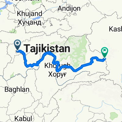
 Pamir Highway
- Distance
- 1,382.1 km
- Ascent
- 16,138 m
- Descent
- 15,972 m
- Location
- Dushanbe, Dushanbe, Tajikistan
 Tadschikistan Teil 1
- Distance
- 327.3 km
- Ascent
- 4,815 m
- Descent
- 4,753 m
- Location
- Dushanbe, Dushanbe, Tajikistan
Open it in the app