

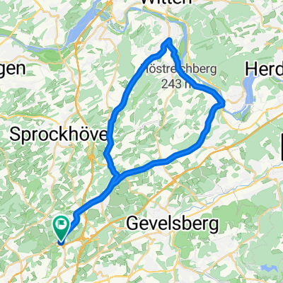
Route in Sprockhövel
A cycling route starting in Sprockhövel, North Rhine-Westphalia, Germany.
Overview
About this route
- 26 min
- Duration
- 6.2 km
- Distance
- 130 m
- Ascent
- 38 m
- Descent
- 14.3 km/h
- Avg. speed
- 310 m
- Max. altitude
Route quality
Waytypes & surfaces along the route
Waytypes
Path
2.9 km
(47 %)
Quiet road
2.1 km
(34 %)
Surfaces
Paved
3.2 km
(52 %)
Unpaved
3 km
(48 %)
Asphalt
3.2 km
(52 %)
Gravel
3 km
(48 %)
Continue with Bikemap
Use, edit, or download this cycling route
You would like to ride Route in Sprockhövel or customize it for your own trip? Here is what you can do with this Bikemap route:
Free features
- Save this route as favorite or in collections
- Copy & plan your own version of this route
- Sync your route with Garmin or Wahoo
Premium features
Free trial for 3 days, or one-time payment. More about Bikemap Premium.
- Navigate this route on iOS & Android
- Export a GPX / KML file of this route
- Create your custom printout (try it for free)
- Download this route for offline navigation
Discover more Premium features.
Get Bikemap PremiumFrom our community
Other popular routes starting in Sprockhövel
 Von Ruhr zur Ruhr ab Langerfeld
- Distance
- 72 km
- Ascent
- 452 m
- Descent
- 452 m
- Location
- Sprockhövel, North Rhine-Westphalia, Germany
 Von Ruhr zur Ruhr
- Distance
- 56.9 km
- Ascent
- 315 m
- Descent
- 314 m
- Location
- Sprockhövel, North Rhine-Westphalia, Germany
 Barmen
- Distance
- 15 km
- Ascent
- 206 m
- Descent
- 295 m
- Location
- Sprockhövel, North Rhine-Westphalia, Germany
 Elfringhauser Schweiz
- Distance
- 23.4 km
- Ascent
- 308 m
- Descent
- 307 m
- Location
- Sprockhövel, North Rhine-Westphalia, Germany
 Schöne Feierabendrunde
- Distance
- 33.5 km
- Ascent
- 320 m
- Descent
- 349 m
- Location
- Sprockhövel, North Rhine-Westphalia, Germany
 Von Sprockhövel bis Hattingen
- Distance
- 22 km
- Ascent
- 341 m
- Descent
- 445 m
- Location
- Sprockhövel, North Rhine-Westphalia, Germany
 68 Km - Sprockhövel - Baldeneysee
- Distance
- 68.5 km
- Ascent
- 226 m
- Descent
- 224 m
- Location
- Sprockhövel, North Rhine-Westphalia, Germany
 Route in Sprockhövel
- Distance
- 6.2 km
- Ascent
- 130 m
- Descent
- 38 m
- Location
- Sprockhövel, North Rhine-Westphalia, Germany
Open it in the app