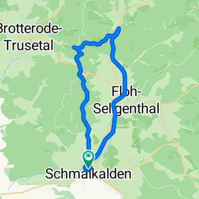
Mommelstein-Spießberg-Runde
- 43.3 km
- 892 m
- 754 m
- Schmalkalden, Thuringia, Germany
A cycling route starting in Schmalkalden, Thuringia, Germany.
Overview
created this 16 years ago
Route quality
Track
25.5 km
(59 %)
Cycleway
8.7 km
(20 %)
Paved
17.8 km
(41 %)
Unpaved
24.2 km
(56 %)
Gravel
18.6 km
(43 %)
Asphalt
17.3 km
(40 %)
Continue with Bikemap
You would like to ride Mommelstein-Spießberg-Runde or customize it for your own trip? Here is what you can do with this Bikemap route:
Free trial for 3 days, or one-time payment. More about Bikemap Premium.
Discover more Premium features.
Get Bikemap PremiumFrom our community
Open it in the app