

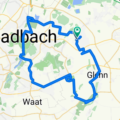
Route in Korschenbroich
A cycling route starting in Korschenbroich, North Rhine-Westphalia, Germany.
Overview
About this route
- 2 h 24 min
- Duration
- 38.8 km
- Distance
- 51 m
- Ascent
- 52 m
- Descent
- 16.1 km/h
- Avg. speed
- 55 m
- Max. altitude
Route quality
Waytypes & surfaces along the route
Waytypes
Path
17.2 km
(44 %)
Quiet road
9 km
(23 %)
Surfaces
Paved
25.8 km
(66 %)
Unpaved
3.3 km
(9 %)
Asphalt
19.3 km
(50 %)
Paved (undefined)
6.5 km
(17 %)
Continue with Bikemap
Use, edit, or download this cycling route
You would like to ride Route in Korschenbroich or customize it for your own trip? Here is what you can do with this Bikemap route:
Free features
- Save this route as favorite or in collections
- Copy & plan your own version of this route
- Sync your route with Garmin or Wahoo
Premium features
Free trial for 3 days, or one-time payment. More about Bikemap Premium.
- Navigate this route on iOS & Android
- Export a GPX / KML file of this route
- Create your custom printout (try it for free)
- Download this route for offline navigation
Discover more Premium features.
Get Bikemap PremiumFrom our community
Other popular routes starting in Korschenbroich
 Trainingsrunde Anstel
- Distance
- 53.4 km
- Ascent
- 95 m
- Descent
- 97 m
- Location
- Korschenbroich, North Rhine-Westphalia, Germany
 Kaarst-Niers 20
- Distance
- 20.9 km
- Ascent
- 23 m
- Descent
- 24 m
- Location
- Korschenbroich, North Rhine-Westphalia, Germany
 Route 007 (KB-Glehn-SchlossDyck-KB)
- Distance
- 26.8 km
- Ascent
- 38 m
- Descent
- 41 m
- Location
- Korschenbroich, North Rhine-Westphalia, Germany
 Korschenbroich - Genhülsen (Niers)
- Distance
- 12.2 km
- Ascent
- 63 m
- Descent
- 28 m
- Location
- Korschenbroich, North Rhine-Westphalia, Germany
 Von Schloss zu Schloss in Mönchengladbachs Osten
- Distance
- 36.5 km
- Ascent
- 330 m
- Descent
- 379 m
- Location
- Korschenbroich, North Rhine-Westphalia, Germany
 Korschenbroich 1
- Distance
- 23.7 km
- Ascent
- 31 m
- Descent
- 28 m
- Location
- Korschenbroich, North Rhine-Westphalia, Germany
 ALT-79-NRET-2025-MG-Korschenbroich-Kaarst-MG
- Distance
- 29.8 km
- Ascent
- 23 m
- Descent
- 26 m
- Location
- Korschenbroich, North Rhine-Westphalia, Germany
 Schloesser Dyck und Myllendonk
- Distance
- 24.1 km
- Ascent
- 32 m
- Descent
- 31 m
- Location
- Korschenbroich, North Rhine-Westphalia, Germany
Open it in the app