

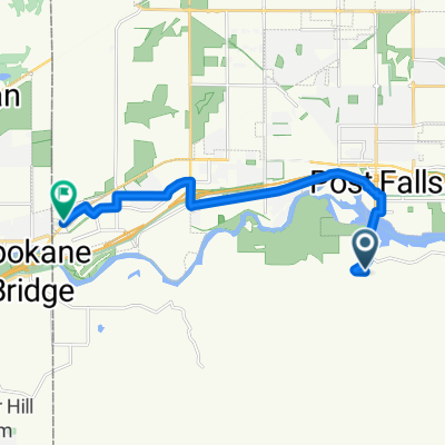
Route in Post Falls
A cycling route starting in Post Falls, Idaho, United States of America.
Overview
About this route
- 28 min
- Duration
- 8 km
- Distance
- 34 m
- Ascent
- 24 m
- Descent
- 17.5 km/h
- Avg. speed
- 676 m
- Max. altitude

Route quality
Waytypes & surfaces along the route
Waytypes
Cycleway
5.5 km
(68 %)
Quiet road
1.6 km
(19 %)
Surfaces
Paved
5.5 km
(68 %)
Asphalt
5.5 km
(68 %)
Undefined
2.6 km
(32 %)
Continue with Bikemap
Use, edit, or download this cycling route
You would like to ride Route in Post Falls or customize it for your own trip? Here is what you can do with this Bikemap route:
Free features
- Save this route as favorite or in collections
- Copy & plan your own version of this route
- Sync your route with Garmin or Wahoo
Premium features
Free trial for 3 days, or one-time payment. More about Bikemap Premium.
- Navigate this route on iOS & Android
- Export a GPX / KML file of this route
- Create your custom printout (try it for free)
- Download this route for offline navigation
Discover more Premium features.
Get Bikemap PremiumFrom our community
Other popular routes starting in Post Falls
 North Chase Road 1418, Post Falls to Northwest Boulevard 2200, Coeur d'Alene
- Distance
- 15.8 km
- Ascent
- 68 m
- Descent
- 49 m
- Location
- Post Falls, Idaho, United States of America
 W Centennial Trail, Post Falls to 208 S Third St, Coeur d'Alene
- Distance
- 11.7 km
- Ascent
- 102 m
- Descent
- 125 m
- Location
- Post Falls, Idaho, United States of America
 Route in Post Falls
- Distance
- 8 km
- Ascent
- 34 m
- Descent
- 24 m
- Location
- Post Falls, Idaho, United States of America
 10087 N Cliffhouse Rd, Hauser to 25601–25697 SH-53, Hauser
- Distance
- 11.1 km
- Ascent
- 103 m
- Descent
- 134 m
- Location
- Post Falls, Idaho, United States of America
 410 S Timber Ln, Post Falls to 399 S Timber Ln, Post Falls
- Distance
- 5.2 km
- Ascent
- 28 m
- Descent
- 25 m
- Location
- Post Falls, Idaho, United States of America
 655 S Penny Ln, Post Falls to 6902 W Seltice Way, State Line
- Distance
- 10.5 km
- Ascent
- 46 m
- Descent
- 113 m
- Location
- Post Falls, Idaho, United States of America
 West 19th Avenue 108, Post Falls to North Harvard Road 5210, Otis Orchards-East Farms
- Distance
- 19.8 km
- Ascent
- 38 m
- Descent
- 69 m
- Location
- Post Falls, Idaho, United States of America
 725 N Highway 41, Post Falls to 629 North Virginia Ct, Spokane Valley
- Distance
- 32.1 km
- Ascent
- 307 m
- Descent
- 350 m
- Location
- Post Falls, Idaho, United States of America
Open it in the app