

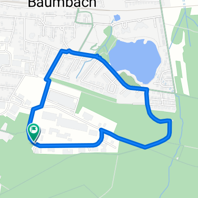
Von Ransbach-Baumbach bis Montabaur
A cycling route starting in Ransbach-Baumbach, Rhineland-Palatinate, Germany.
Overview
About this route
- 3 h 52 min
- Duration
- 52 km
- Distance
- 887 m
- Ascent
- 658 m
- Descent
- 13.5 km/h
- Avg. speed
- 556 m
- Max. altitude

Route quality
Waytypes & surfaces along the route
Waytypes
Track
23.9 km
(46 %)
Quiet road
12 km
(23 %)
Surfaces
Paved
14.6 km
(28 %)
Unpaved
22.9 km
(44 %)
Gravel
14.6 km
(28 %)
Asphalt
10.9 km
(21 %)
Continue with Bikemap
Use, edit, or download this cycling route
You would like to ride Von Ransbach-Baumbach bis Montabaur or customize it for your own trip? Here is what you can do with this Bikemap route:
Free features
- Save this route as favorite or in collections
- Copy & plan your own version of this route
- Sync your route with Garmin or Wahoo
Premium features
Free trial for 3 days, or one-time payment. More about Bikemap Premium.
- Navigate this route on iOS & Android
- Export a GPX / KML file of this route
- Create your custom printout (try it for free)
- Download this route for offline navigation
Discover more Premium features.
Get Bikemap PremiumFrom our community
Other popular routes starting in Ransbach-Baumbach
 Langsame Fahrt in Ransbach-Baumbach
- Distance
- 17.1 km
- Ascent
- 433 m
- Descent
- 430 m
- Location
- Ransbach-Baumbach, Rhineland-Palatinate, Germany
 Von Ransbach-Baumbach bis Montabaur
- Distance
- 52 km
- Ascent
- 887 m
- Descent
- 658 m
- Location
- Ransbach-Baumbach, Rhineland-Palatinate, Germany
 Erlenhofsee
- Distance
- 2.6 km
- Ascent
- 44 m
- Descent
- 45 m
- Location
- Ransbach-Baumbach, Rhineland-Palatinate, Germany
 Gravel Tour
- Distance
- 41.6 km
- Ascent
- 568 m
- Descent
- 566 m
- Location
- Ransbach-Baumbach, Rhineland-Palatinate, Germany
 Psy2007
- Distance
- 9.7 km
- Ascent
- 112 m
- Descent
- 178 m
- Location
- Ransbach-Baumbach, Rhineland-Palatinate, Germany
 Um den Köppel
- Distance
- 25 km
- Ascent
- 398 m
- Descent
- 433 m
- Location
- Ransbach-Baumbach, Rhineland-Palatinate, Germany
 Ä?A?? nach Ä?A??
- Distance
- 11.1 km
- Ascent
- 413 m
- Descent
- 416 m
- Location
- Ransbach-Baumbach, Rhineland-Palatinate, Germany
 Baumbacher Westerwaldrunde
- Distance
- 63 km
- Ascent
- 691 m
- Descent
- 707 m
- Location
- Ransbach-Baumbach, Rhineland-Palatinate, Germany
Open it in the app