

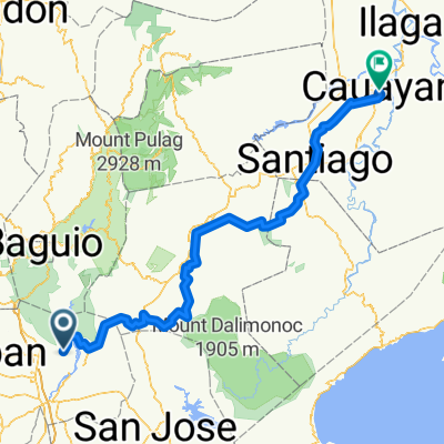
Route to Cauayan
A cycling route starting in San Manuel, Ilocos, Philippines.
Overview
About this route
- 19 h 48 min
- Duration
- 274.5 km
- Distance
- 6,862 m
- Ascent
- 6,864 m
- Descent
- 13.9 km/h
- Avg. speed
- 1,336 m
- Max. altitude

Route quality
Waytypes & surfaces along the route
Waytypes
Quiet road
181.1 km
(66 %)
Road
49.4 km
(18 %)
Surfaces
Paved
22 km
(8 %)
Unpaved
19.2 km
(7 %)
Concrete
22 km
(8 %)
Unpaved (undefined)
16.5 km
(6 %)
Continue with Bikemap
Use, edit, or download this cycling route
You would like to ride Route to Cauayan or customize it for your own trip? Here is what you can do with this Bikemap route:
Free features
- Save this route as favorite or in collections
- Copy & plan your own version of this route
- Split it into stages to create a multi-day tour
- Sync your route with Garmin or Wahoo
Premium features
Free trial for 3 days, or one-time payment. More about Bikemap Premium.
- Navigate this route on iOS & Android
- Export a GPX / KML file of this route
- Create your custom printout (try it for free)
- Download this route for offline navigation
Discover more Premium features.
Get Bikemap PremiumFrom our community
Other popular routes starting in San Manuel
 Snail-like route in San Manuel
- Distance
- 8.9 km
- Ascent
- 89 m
- Descent
- 130 m
- Location
- San Manuel, Ilocos, Philippines
 laclac
- Distance
- 25.5 km
- Ascent
- 661 m
- Descent
- 691 m
- Location
- San Manuel, Ilocos, Philippines
 aaaaaa
- Distance
- 31.2 km
- Ascent
- 46 m
- Descent
- 44 m
- Location
- San Manuel, Ilocos, Philippines
 From San Manuel to Diadi
- Distance
- 254.4 km
- Ascent
- 7,341 m
- Descent
- 7,183 m
- Location
- San Manuel, Ilocos, Philippines
 Route to Cauayan
- Distance
- 274.5 km
- Ascent
- 6,862 m
- Descent
- 6,864 m
- Location
- San Manuel, Ilocos, Philippines
 my cycling route to my loves
- Distance
- 23.5 km
- Ascent
- 13 m
- Descent
- 34 m
- Location
- San Manuel, Ilocos, Philippines
Open it in the app