

Route U/O-Heinriet Teusserbad Eschenau WEA Hirrweiler Heinriet Abstatt und zurück
A cycling route starting in Untergruppenbach, Baden-Wurttemberg, Germany.
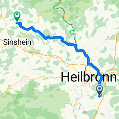
Overview
About this route
- 4 h 18 min
- Duration
- 45.2 km
- Distance
- 1,090 m
- Ascent
- 1,090 m
- Descent
- 10.5 km/h
- Avg. speed
- 517 m
- Max. altitude
Route quality
Waytypes & surfaces along the route
Waytypes
Track
29.1 km
(64 %)
Quiet road
5.9 km
(13 %)
Surfaces
Paved
15.4 km
(34 %)
Unpaved
25.6 km
(57 %)
Gravel
19.1 km
(42 %)
Asphalt
14.4 km
(32 %)
Continue with Bikemap
Use, edit, or download this cycling route
You would like to ride Route U/O-Heinriet Teusserbad Eschenau WEA Hirrweiler Heinriet Abstatt und zurück or customize it for your own trip? Here is what you can do with this Bikemap route:
Free features
- Save this route as favorite or in collections
- Copy & plan your own version of this route
- Sync your route with Garmin or Wahoo
Premium features
Free trial for 3 days, or one-time payment. More about Bikemap Premium.
- Navigate this route on iOS & Android
- Export a GPX / KML file of this route
- Create your custom printout (try it for free)
- Download this route for offline navigation
Discover more Premium features.
Get Bikemap PremiumFrom our community
Other popular routes starting in Untergruppenbach
 Untergruppenbach - Burg Stettenfels
- Distance
- 5.8 km
- Ascent
- 86 m
- Descent
- 88 m
- Location
- Untergruppenbach, Baden-Wurttemberg, Germany
 54 km U-bach - Eschelbronn
- Distance
- 53.2 km
- Ascent
- 256 m
- Descent
- 356 m
- Location
- Untergruppenbach, Baden-Wurttemberg, Germany
 Rundweg Weinsberger Tal,Breit.See,Ugrbach
- Distance
- 29.7 km
- Ascent
- 308 m
- Descent
- 307 m
- Location
- Untergruppenbach, Baden-Wurttemberg, Germany
 MTB Tour Nr. 4 - BurgenTour
- Distance
- 30.4 km
- Ascent
- 589 m
- Descent
- 586 m
- Location
- Untergruppenbach, Baden-Wurttemberg, Germany
 SB6 Schnuppertour im Naturpark
- Distance
- 21.8 km
- Ascent
- 434 m
- Descent
- 435 m
- Location
- Untergruppenbach, Baden-Wurttemberg, Germany
 Hirrweiler - Unterheimbach - Hirrweiler
- Distance
- 61.8 km
- Ascent
- 766 m
- Descent
- 788 m
- Location
- Untergruppenbach, Baden-Wurttemberg, Germany
 Kaudenwald->Waldheide-Köpfer->Gaffenberg
- Distance
- 20.6 km
- Ascent
- 404 m
- Descent
- 386 m
- Location
- Untergruppenbach, Baden-Wurttemberg, Germany
 Kaudenwald->Reisbergbrücke and back
- Distance
- 9.1 km
- Ascent
- 191 m
- Descent
- 177 m
- Location
- Untergruppenbach, Baden-Wurttemberg, Germany
Open it in the app