

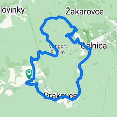
GL-ch.Erika- Kojš.Hoľa - Zl.Idka- Bukovec v.n.
A cycling route starting in Gelnica, Košice Region, Slovakia.
Overview
About this route
Asphalt - roads, dirt / forest roads
- -:--
- Duration
- 39 km
- Distance
- 1,069 m
- Ascent
- 1,073 m
- Descent
- ---
- Avg. speed
- 1,171 m
- Max. altitude

Continue with Bikemap
Use, edit, or download this cycling route
You would like to ride GL-ch.Erika- Kojš.Hoľa - Zl.Idka- Bukovec v.n. or customize it for your own trip? Here is what you can do with this Bikemap route:
Free features
- Save this route as favorite or in collections
- Copy & plan your own version of this route
- Sync your route with Garmin or Wahoo
Premium features
Free trial for 3 days, or one-time payment. More about Bikemap Premium.
- Navigate this route on iOS & Android
- Export a GPX / KML file of this route
- Create your custom printout (try it for free)
- Download this route for offline navigation
Discover more Premium features.
Get Bikemap PremiumFrom our community
Other popular routes starting in Gelnica
 Palenčáreň 2015 "dlhá"
- Distance
- 63.4 km
- Ascent
- 1,425 m
- Descent
- 1,425 m
- Location
- Gelnica, Košice Region, Slovakia
 18.11.2011
- Distance
- 27.5 km
- Ascent
- 646 m
- Descent
- 646 m
- Location
- Gelnica, Košice Region, Slovakia
 Okolo Ružína
- Distance
- 44.7 km
- Ascent
- 948 m
- Descent
- 953 m
- Location
- Gelnica, Košice Region, Slovakia
 Z02 Spis - Javorina
- Distance
- 222.8 km
- Ascent
- 1,984 m
- Descent
- 1,799 m
- Location
- Gelnica, Košice Region, Slovakia
 My favorite
- Distance
- 16 km
- Ascent
- 808 m
- Descent
- 803 m
- Location
- Gelnica, Košice Region, Slovakia
 Ružín
Ružín- Distance
- 47.2 km
- Ascent
- 609 m
- Descent
- 609 m
- Location
- Gelnica, Košice Region, Slovakia
 Palenčáreň 2015 "krátka"
- Distance
- 31.9 km
- Ascent
- 787 m
- Descent
- 787 m
- Location
- Gelnica, Košice Region, Slovakia
 Gelnica - Margecany - Ružín - Koš.Belá - Jahodná
- Distance
- 38.3 km
- Ascent
- 908 m
- Descent
- 671 m
- Location
- Gelnica, Košice Region, Slovakia
Open it in the app