

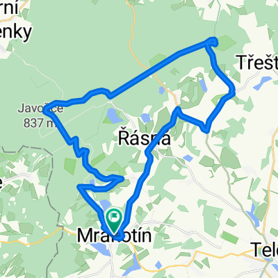
Trasa z Telč do Čestín
A cycling route starting in Telč, Kraj Vysočina, Czechia.
Overview
About this route
- -:--
- Duration
- 128.9 km
- Distance
- 2,774 m
- Ascent
- 2,792 m
- Descent
- ---
- Avg. speed
- 774 m
- Max. altitude
Continue with Bikemap
Use, edit, or download this cycling route
You would like to ride Trasa z Telč do Čestín or customize it for your own trip? Here is what you can do with this Bikemap route:
Free features
- Save this route as favorite or in collections
- Copy & plan your own version of this route
- Split it into stages to create a multi-day tour
- Sync your route with Garmin or Wahoo
Premium features
Free trial for 3 days, or one-time payment. More about Bikemap Premium.
- Navigate this route on iOS & Android
- Export a GPX / KML file of this route
- Create your custom printout (try it for free)
- Download this route for offline navigation
Discover more Premium features.
Get Bikemap PremiumFrom our community
Other popular routes starting in Telč
 EKIB2009 5.etapa
- Distance
- 27.1 km
- Ascent
- 400 m
- Descent
- 400 m
- Location
- Telč, Kraj Vysočina, Czechia
 Day13 Litomyšl
- Distance
- 126.7 km
- Ascent
- 697 m
- Descent
- 884 m
- Location
- Telč, Kraj Vysočina, Czechia
 Jindřichův Hradec - Týnec nad Sázavou
- Distance
- 88 km
- Ascent
- 1,283 m
- Descent
- 1,356 m
- Location
- Telč, Kraj Vysočina, Czechia
 okolo Telče
- Distance
- 58.1 km
- Ascent
- 718 m
- Descent
- 721 m
- Location
- Telč, Kraj Vysočina, Czechia
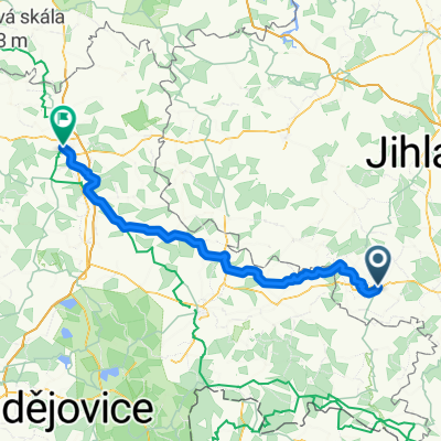
 Z Řásné do Jihlavy
- Distance
- 30.2 km
- Ascent
- 354 m
- Descent
- 464 m
- Location
- Telč, Kraj Vysočina, Czechia
 Trasa z Telč do Čestín
- Distance
- 128.9 km
- Ascent
- 2,774 m
- Descent
- 2,792 m
- Location
- Telč, Kraj Vysočina, Czechia
 Vysočina
- Distance
- 243.9 km
- Ascent
- 1,361 m
- Descent
- 1,364 m
- Location
- Telč, Kraj Vysočina, Czechia
 Řásná-Telč-Javořice-Řásná
- Distance
- 27.4 km
- Ascent
- 449 m
- Descent
- 449 m
- Location
- Telč, Kraj Vysočina, Czechia
Open it in the app