

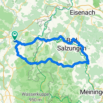
RR Hohenroda - B. Hersfeld - Ho
A cycling route starting in Schenklengsfeld, Hesse, Germany.
Overview
About this route
- 3 h 17 min
- Duration
- 56.6 km
- Distance
- 777 m
- Ascent
- 777 m
- Descent
- 17.2 km/h
- Avg. speed
- 417 m
- Max. altitude

Route quality
Waytypes & surfaces along the route
Waytypes
Path
18.7 km
(33 %)
Quiet road
15.8 km
(28 %)
Surfaces
Paved
52.6 km
(93 %)
Asphalt
44.7 km
(79 %)
Paved (undefined)
7.4 km
(13 %)
Continue with Bikemap
Use, edit, or download this cycling route
You would like to ride RR Hohenroda - B. Hersfeld - Ho or customize it for your own trip? Here is what you can do with this Bikemap route:
Free features
- Save this route as favorite or in collections
- Copy & plan your own version of this route
- Sync your route with Garmin or Wahoo
Premium features
Free trial for 3 days, or one-time payment. More about Bikemap Premium.
- Navigate this route on iOS & Android
- Export a GPX / KML file of this route
- Create your custom printout (try it for free)
- Download this route for offline navigation
Discover more Premium features.
Get Bikemap PremiumFrom our community
Other popular routes starting in Schenklengsfeld
 Saisonbedingt 2017
- Distance
- 25.6 km
- Ascent
- 223 m
- Descent
- 210 m
- Location
- Schenklengsfeld, Hesse, Germany
 RR Hohenroda - Vacha - Ho
- Distance
- 71.9 km
- Ascent
- 1,047 m
- Descent
- 1,036 m
- Location
- Schenklengsfeld, Hesse, Germany
 Königsetappe125
- Distance
- 126.8 km
- Ascent
- 834 m
- Descent
- 834 m
- Location
- Schenklengsfeld, Hesse, Germany
 Hohenroda - Vacha - Ho
- Distance
- 27.5 km
- Ascent
- 385 m
- Descent
- 388 m
- Location
- Schenklengsfeld, Hesse, Germany
 Rosenweg 2, Hohenroda nach Rosenweg 1, Hohenroda
- Distance
- 20.8 km
- Ascent
- 637 m
- Descent
- 635 m
- Location
- Schenklengsfeld, Hesse, Germany
 Ulstertal und Kegelradweg
- Distance
- 46.6 km
- Ascent
- 242 m
- Descent
- 243 m
- Location
- Schenklengsfeld, Hesse, Germany
 Hohenroda - Friedewald - Ho
- Distance
- 29.8 km
- Ascent
- 456 m
- Descent
- 460 m
- Location
- Schenklengsfeld, Hesse, Germany
 Rund um die Wippershainer Höhe
- Distance
- 23.9 km
- Ascent
- 302 m
- Descent
- 302 m
- Location
- Schenklengsfeld, Hesse, Germany
Open it in the app