

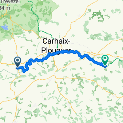
Route to Guipavas
A cycling route starting in Châteauneuf-du-Faou, Brittany Region, France.
Overview
About this route
- 5 h 16 min
- Duration
- 86.2 km
- Distance
- 1,137 m
- Ascent
- 1,204 m
- Descent
- 16.4 km/h
- Avg. speed
- 165 m
- Max. altitude
Route quality
Waytypes & surfaces along the route
Waytypes
Quiet road
31.9 km
(37 %)
Road
25.9 km
(30 %)
Surfaces
Paved
36.2 km
(42 %)
Unpaved
6.9 km
(8 %)
Asphalt
36.2 km
(42 %)
Gravel
6 km
(7 %)
Continue with Bikemap
Use, edit, or download this cycling route
You would like to ride Route to Guipavas or customize it for your own trip? Here is what you can do with this Bikemap route:
Free features
- Save this route as favorite or in collections
- Copy & plan your own version of this route
- Split it into stages to create a multi-day tour
- Sync your route with Garmin or Wahoo
Premium features
Free trial for 3 days, or one-time payment. More about Bikemap Premium.
- Navigate this route on iOS & Android
- Export a GPX / KML file of this route
- Create your custom printout (try it for free)
- Download this route for offline navigation
Discover more Premium features.
Get Bikemap PremiumFrom our community
Other popular routes starting in Châteauneuf-du-Faou
 Châteauneuf-du-Faou - Carhaix-Plouguer
- Distance
- 63 km
- Ascent
- 726 m
- Descent
- 663 m
- Location
- Châteauneuf-du-Faou, Brittany Region, France
 De Rue de la Mairie 12, Châteauneuf-du-Faou à Rue de Veillenec 12, Daoulas
- Distance
- 49.8 km
- Ascent
- 663 m
- Descent
- 736 m
- Location
- Châteauneuf-du-Faou, Brittany Region, France
 De Rue de Penn ar Roz 17, Châteauneuf-du-Faou à D36, Saint-Goazec
- Distance
- 4.8 km
- Ascent
- 170 m
- Descent
- 40 m
- Location
- Châteauneuf-du-Faou, Brittany Region, France
 Itinéraire vers Rue de Penn ar Roz 17, Châteauneuf-du-Faou
- Distance
- 29.8 km
- Ascent
- 768 m
- Descent
- 754 m
- Location
- Châteauneuf-du-Faou, Brittany Region, France
 jour 4 - chateauneuf du faou- brasparts
- Distance
- 26.7 km
- Ascent
- 404 m
- Descent
- 321 m
- Location
- Châteauneuf-du-Faou, Brittany Region, France
 Itinéraire à partir de 17 Rue Paul Sérusier, Châteauneuf-du-Faou
- Distance
- 45.4 km
- Ascent
- 57 m
- Descent
- 144 m
- Location
- Châteauneuf-du-Faou, Brittany Region, France
 De D36, Saint-Goazec à Rue de la Mairie 12, Châteauneuf-du-Faou
- Distance
- 5.9 km
- Ascent
- 66 m
- Descent
- 203 m
- Location
- Châteauneuf-du-Faou, Brittany Region, France
 Route to Guipavas
- Distance
- 86.2 km
- Ascent
- 1,137 m
- Descent
- 1,204 m
- Location
- Châteauneuf-du-Faou, Brittany Region, France
Open it in the app