

2005 Wörnitz-Lech bis Augsburg
A cycling route starting in Oettingen in Bayern, Bavaria, Germany.
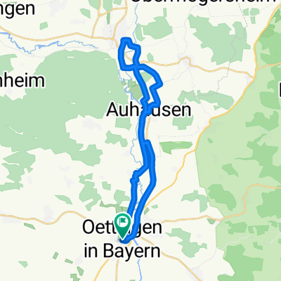
Overview
About this route
Lechauen, shady, especially the old arm, in nice weather vacation feeling, gravel benches everywhere for swimming...
- -:--
- Duration
- 84.5 km
- Distance
- 268 m
- Ascent
- 226 m
- Descent
- ---
- Avg. speed
- 461 m
- Max. altitude
Route quality
Waytypes & surfaces along the route
Waytypes
Track
26.2 km
(31 %)
Quiet road
21.1 km
(25 %)
Surfaces
Paved
40.5 km
(48 %)
Unpaved
30.4 km
(36 %)
Asphalt
38.9 km
(46 %)
Gravel
22 km
(26 %)
Route highlights
Points of interest along the route
Point of interest after 19.6 km
Ü Platz
Point of interest after 84.4 km
Pension Märkl
Continue with Bikemap
Use, edit, or download this cycling route
You would like to ride 2005 Wörnitz-Lech bis Augsburg or customize it for your own trip? Here is what you can do with this Bikemap route:
Free features
- Save this route as favorite or in collections
- Copy & plan your own version of this route
- Split it into stages to create a multi-day tour
- Sync your route with Garmin or Wahoo
Premium features
Free trial for 3 days, or one-time payment. More about Bikemap Premium.
- Navigate this route on iOS & Android
- Export a GPX / KML file of this route
- Create your custom printout (try it for free)
- Download this route for offline navigation
Discover more Premium features.
Get Bikemap PremiumFrom our community
Other popular routes starting in Oettingen in Bayern
 Oettingen-Wassertrüdingen-Oettingen
- Distance
- 24.5 km
- Ascent
- 37 m
- Descent
- 37 m
- Location
- Oettingen in Bayern, Bavaria, Germany
 Oettingen-Wechingen-Lierheim-Oettingen
- Distance
- 49.4 km
- Ascent
- 41 m
- Descent
- 40 m
- Location
- Oettingen in Bayern, Bavaria, Germany
 große Hahnenkammrunde
- Distance
- 52.2 km
- Ascent
- 719 m
- Descent
- 683 m
- Location
- Oettingen in Bayern, Bavaria, Germany
 Rennradrunde Öttingen Dinkelsbühl Altmühlsee
- Distance
- 115.2 km
- Ascent
- 387 m
- Descent
- 387 m
- Location
- Oettingen in Bayern, Bavaria, Germany
 Oettingen Wemding Nördlingen Oettingen
- Distance
- 51.1 km
- Ascent
- 119 m
- Descent
- 119 m
- Location
- Oettingen in Bayern, Bavaria, Germany
 2005 Wörnitz-Lech bis Augsburg
- Distance
- 84.5 km
- Ascent
- 268 m
- Descent
- 226 m
- Location
- Oettingen in Bayern, Bavaria, Germany
 Oettingen-Megesheim-Laub-Munningen
- Distance
- 19.8 km
- Ascent
- 56 m
- Descent
- 56 m
- Location
- Oettingen in Bayern, Bavaria, Germany
 Oettingen-Eitersberg-Weiltingen-Oettingen
- Distance
- 42.7 km
- Ascent
- 407 m
- Descent
- 406 m
- Location
- Oettingen in Bayern, Bavaria, Germany
Open it in the app