

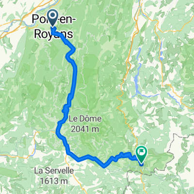
Combe Laval- Col de la Bataille
A cycling route starting in Pont-en-Royans, Auvergne-Rhône-Alpes, France.
Overview
About this route
- -:--
- Duration
- 118.4 km
- Distance
- 4,153 m
- Ascent
- 4,154 m
- Descent
- ---
- Avg. speed
- 1,449 m
- Max. altitude

Continue with Bikemap
Use, edit, or download this cycling route
You would like to ride Combe Laval- Col de la Bataille or customize it for your own trip? Here is what you can do with this Bikemap route:
Free features
- Save this route as favorite or in collections
- Copy & plan your own version of this route
- Split it into stages to create a multi-day tour
- Sync your route with Garmin or Wahoo
Premium features
Free trial for 3 days, or one-time payment. More about Bikemap Premium.
- Navigate this route on iOS & Android
- Export a GPX / KML file of this route
- Create your custom printout (try it for free)
- Download this route for offline navigation
Discover more Premium features.
Get Bikemap PremiumFrom our community
Other popular routes starting in Pont-en-Royans
 3 ème étape Summer Ride
- Distance
- 103.8 km
- Ascent
- 2,026 m
- Descent
- 1,219 m
- Location
- Pont-en-Royans, Auvergne-Rhône-Alpes, France
 Sud de Vercors
- Distance
- 123.8 km
- Ascent
- 2,596 m
- Descent
- 2,596 m
- Location
- Pont-en-Royans, Auvergne-Rhône-Alpes, France
 2016 Ride Day 152 - Pont-en-Royans to Valence
- Distance
- 67.2 km
- Ascent
- 984 m
- Descent
- 1,074 m
- Location
- Pont-en-Royans, Auvergne-Rhône-Alpes, France
 Vercors: Five Cols, Two Gorges
- Distance
- 76.9 km
- Ascent
- 2,194 m
- Descent
- 2,194 m
- Location
- Pont-en-Royans, Auvergne-Rhône-Alpes, France
 Combe Laval- Col de la Bataille
- Distance
- 118.4 km
- Ascent
- 4,153 m
- Descent
- 4,154 m
- Location
- Pont-en-Royans, Auvergne-Rhône-Alpes, France
 quaeldich Route 3 50km
- Distance
- 23.5 km
- Ascent
- 1,703 m
- Descent
- 940 m
- Location
- Pont-en-Royans, Auvergne-Rhône-Alpes, France
 Vercors par Pont sans Villard
- Distance
- 94.5 km
- Ascent
- 1,784 m
- Descent
- 1,784 m
- Location
- Pont-en-Royans, Auvergne-Rhône-Alpes, France
 Vercors: Combe Laval
- Distance
- 56.6 km
- Ascent
- 1,186 m
- Descent
- 1,185 m
- Location
- Pont-en-Royans, Auvergne-Rhône-Alpes, France
Open it in the app