

T Pavia Lucca EV5
A cycling route starting in Pavia, Lombardy, Italy.
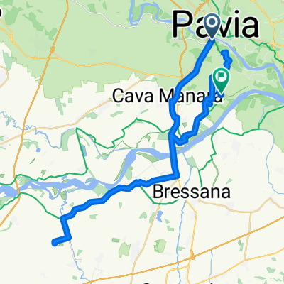
Overview
About this route
Route calculated with http://www.bicitalia.org/it/routing-gpx
- 19 h 35 min
- Duration
- 311.4 km
- Distance
- 2,147 m
- Ascent
- 2,199 m
- Descent
- 15.9 km/h
- Avg. speed
- 1,040 m
- Max. altitude

Continue with Bikemap
Use, edit, or download this cycling route
You would like to ride T Pavia Lucca EV5 or customize it for your own trip? Here is what you can do with this Bikemap route:
Free features
- Save this route as favorite or in collections
- Copy & plan your own version of this route
- Split it into stages to create a multi-day tour
- Sync your route with Garmin or Wahoo
Premium features
Free trial for 3 days, or one-time payment. More about Bikemap Premium.
- Navigate this route on iOS & Android
- Export a GPX / KML file of this route
- Create your custom printout (try it for free)
- Download this route for offline navigation
Discover more Premium features.
Get Bikemap PremiumFrom our community
Other popular routes starting in Pavia
 T Pavia Lucca EV5
- Distance
- 311.4 km
- Ascent
- 2,147 m
- Descent
- 2,199 m
- Location
- Pavia, Lombardy, Italy
 T Pavia Empoli EV5
- Distance
- 379.5 km
- Ascent
- 4,424 m
- Descent
- 4,477 m
- Location
- Pavia, Lombardy, Italy
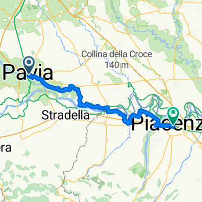 Pavia bis Piacenza
- Distance
- 65.2 km
- Ascent
- 141 m
- Descent
- 166 m
- Location
- Pavia, Lombardy, Italy
 Giro a velocità lenta in Paviaietyma
- Distance
- 40.2 km
- Ascent
- 147 m
- Descent
- 137 m
- Location
- Pavia, Lombardy, Italy
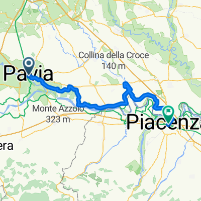 I02Pavia_Piacenza
- Distance
- 76.6 km
- Ascent
- 162 m
- Descent
- 190 m
- Location
- Pavia, Lombardy, Italy
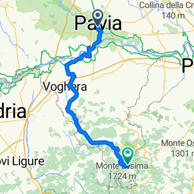 Corso Strada Nuova, Pavia nach SP 89, Brallo di Pregola
- Distance
- 86.1 km
- Ascent
- 1,259 m
- Descent
- 314 m
- Location
- Pavia, Lombardy, Italy
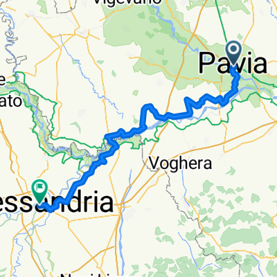 I11PaviaAlexandria
- Distance
- 85.4 km
- Ascent
- 113 m
- Descent
- 103 m
- Location
- Pavia, Lombardy, Italy
 Route zu Il Castello di San Gaudenzio
- Distance
- 54.9 km
- Ascent
- 59 m
- Descent
- 64 m
- Location
- Pavia, Lombardy, Italy
Open it in the app