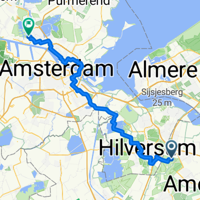
Baarn 675 jaar - Eemlus
A cycling route starting in Baarn, Provincie Utrecht, Netherlands.
Overview
About this route
- 1 h 39 min
- Duration
- 27.7 km
- Distance
- 19 m
- Ascent
- 21 m
- Descent
- 16.8 km/h
- Avg. speed
- 14 m
- Avg. speed
Route quality
Waytypes & surfaces along the route
Waytypes
Quiet road
17.5 km
(63 %)
Cycleway
6.8 km
(25 %)
Surfaces
Paved
18.1 km
(65 %)
Unpaved
0.9 km
(3 %)
Asphalt
14.7 km
(53 %)
Concrete
3.4 km
(12 %)
Continue with Bikemap
Use, edit, or download this cycling route
You would like to ride Baarn 675 jaar - Eemlus or customize it for your own trip? Here is what you can do with this Bikemap route:
Free features
- Save this route as favorite or in collections
- Copy & plan your own version of this route
- Sync your route with Garmin or Wahoo
Premium features
Free trial for 3 days, or one-time payment. More about Bikemap Premium.
- Navigate this route on iOS & Android
- Export a GPX / KML file of this route
- Create your custom printout (try it for free)
- Download this route for offline navigation
Discover more Premium features.
Get Bikemap PremiumFrom our community
Other popular routes starting in Baarn
- Baarn 675 jaar - Eemlus
- Distance
- 27.7 km
- Ascent
- 19 m
- Descent
- 21 m
- Location
- Baarn, Provincie Utrecht, Netherlands
- HGVU Baarn
- Distance
- 29.3 km
- Ascent
- 76 m
- Descent
- 75 m
- Location
- Baarn, Provincie Utrecht, Netherlands
- baarn langs drakenstein
- Distance
- 25.2 km
- Ascent
- 64 m
- Descent
- 62 m
- Location
- Baarn, Provincie Utrecht, Netherlands
- Steady ride in Laren
- Distance
- 6.4 km
- Ascent
- 66 m
- Descent
- 60 m
- Location
- Baarn, Provincie Utrecht, Netherlands
- Rondje 20130713
- Distance
- 75 km
- Ascent
- 83 m
- Descent
- 68 m
- Location
- Baarn, Provincie Utrecht, Netherlands
- 35. Soest, Amersfoort & Lage Vuursche
- Distance
- 52.7 km
- Ascent
- 85 m
- Descent
- 85 m
- Location
- Baarn, Provincie Utrecht, Netherlands
- Eemnes
- Distance
- 33.9 km
- Ascent
- 55 m
- Descent
- 52 m
- Location
- Baarn, Provincie Utrecht, Netherlands
- Kastelen route
- Distance
- 46.2 km
- Ascent
- 36 m
- Descent
- 36 m
- Location
- Baarn, Provincie Utrecht, Netherlands
Open it in the app