Cykel-TRIM 2025, Västerås
A cycling route starting in Västerås, Västmanland County, Sweden.
Overview
About this route
Karta och startkort köps på Sportson i Hälla
- 4 h 7 min
- Duration
- 70.9 km
- Distance
- 423 m
- Ascent
- 432 m
- Descent
- 17.2 km/h
- Avg. speed
- 64 m
- Max. altitude
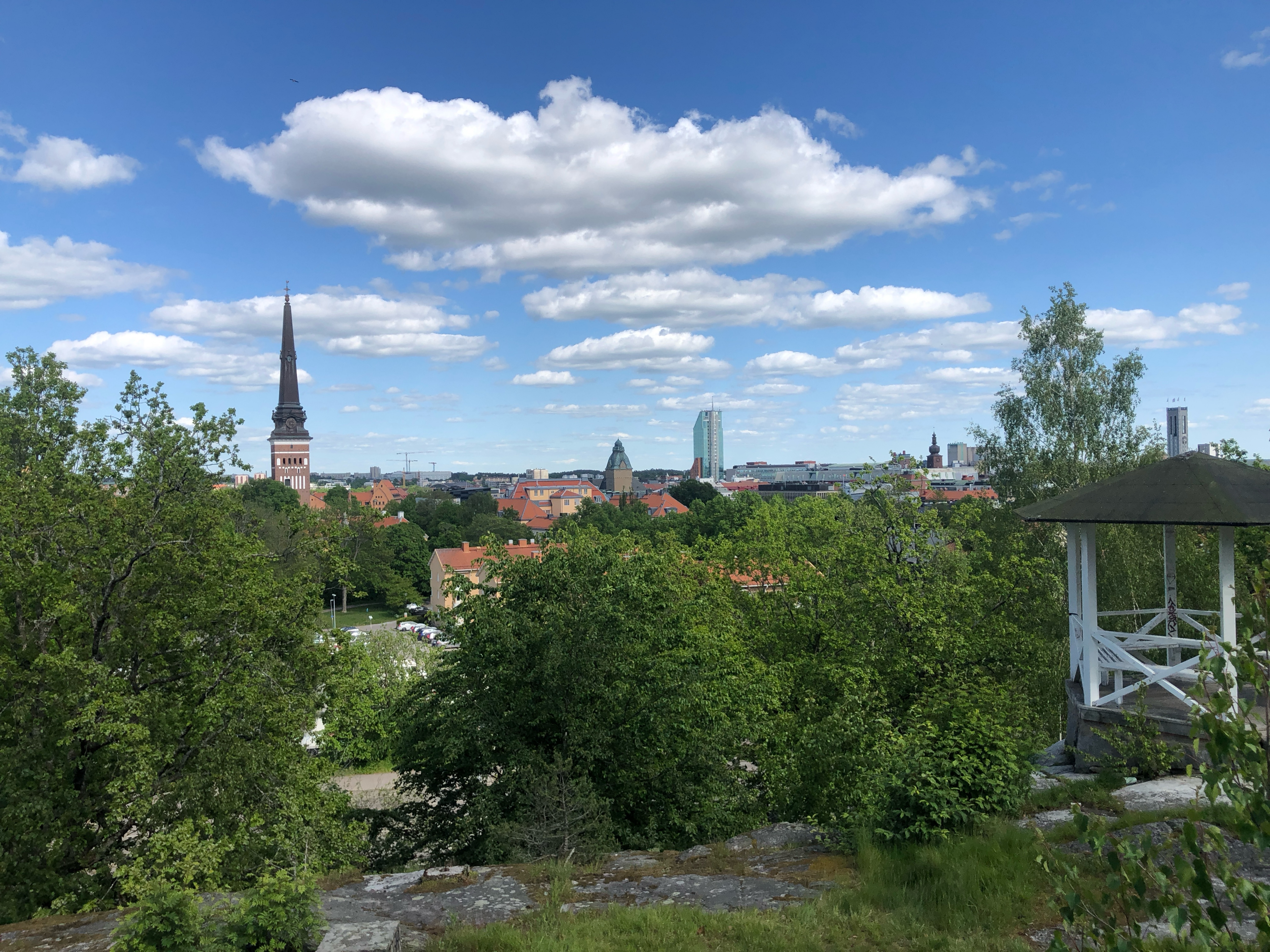
Route photos
Route quality
Waytypes & surfaces along the route
Waytypes
Cycleway
51.8 km
(73 %)
Quiet road
10.6 km
(15 %)
Surfaces
Paved
64.5 km
(91 %)
Unpaved
5.7 km
(8 %)
Asphalt
64.5 km
(91 %)
Unpaved (undefined)
5 km
(7 %)
Route highlights
Points of interest along the route
Point of interest after 0 km
Nr 22, Anslagstavlan
Point of interest after 0 km
Nr 28, Grytahögen
Point of interest after 0 km
Nr 27, Labyrinten
Point of interest after 0.3 km
Nr 31, Fasadskylten
Point of interest after 0.3 km
Nr 30, Träden
Point of interest after 0.4 km
Nr 29, Hundkapplöpningsbanan
Point of interest after 3.4 km
Nr 32, Sportson Hälla
Point of interest after 5.3 km
Nr 26, Torpet
Point of interest after 5.7 km
Nr 18, Kungen
Point of interest after 5.7 km
Nr 17, Konstverket
Point of interest after 20.5 km
Nr 25, Bilverkstaden
Point of interest after 34.4 km
Nr 20, Portnumret
Point of interest after 39.8 km
Nr 14, Repstegen
Point of interest after 42.6 km
Nr 13, Skylten
Point of interest after 43.6 km
Nr 16, Varggropen
Point of interest after 45.4 km
Nr 8, Stenen
Point of interest after 45.8 km
Nr 15, Faunapassagen
Point of interest after 46.3 km
Nr 7, Miljövärnare
Point of interest after 48.6 km
Nr 10, Inkasten
Point of interest after 49.4 km
Nr 21, Skylten
Point of interest after 50.4 km
Nr 9, Fasaden
Point of interest after 51 km
Nr 11, Kraftledningsstolpen
Point of interest after 54.2 km
Nr 3, Urtida boplatsen
Point of interest after 58.1 km
Nr 5, Mulmholken
Point of interest after 58.1 km
Nr 6, Skylten
Point of interest after 59.5 km
Nr 4, Gula bänken
Point of interest after 61.6 km
Nr 23, Uppstigarstigen
Point of interest after 63.6 km
Nr 2, Skylten
Point of interest after 64 km
Nr 1, Brunnslocken
Point of interest after 70.9 km
Nr 24, Boende
Point of interest after 70.9 km
Nr 12, Parkeringen
Point of interest after 70.9 km
Nr 21, Produkten
Continue with Bikemap
Use, edit, or download this cycling route
You would like to ride Cykel-TRIM 2025, Västerås or customize it for your own trip? Here is what you can do with this Bikemap route:
Free features
- Save this route as favorite or in collections
- Copy & plan your own version of this route
- Sync your route with Garmin or Wahoo
Premium features
Free trial for 3 days, or one-time payment. More about Bikemap Premium.
- Navigate this route on iOS & Android
- Export a GPX / KML file of this route
- Create your custom printout (try it for free)
- Download this route for offline navigation
Discover more Premium features.
Get Bikemap PremiumFrom our community
Other popular routes starting in Västerås
 Route to Medley Lögarängsbadet
- Distance
- 73.8 km
- Ascent
- 345 m
- Descent
- 360 m
- Location
- Västerås, Västmanland County, Sweden
 Västeråscykeln 125
- Distance
- 127.4 km
- Ascent
- 0 m
- Descent
- 0 m
- Location
- Västerås, Västmanland County, Sweden
 Asköviken to Krägga
- Distance
- 93.3 km
- Ascent
- 428 m
- Descent
- 408 m
- Location
- Västerås, Västmanland County, Sweden
 Tortuna
- Distance
- 39.6 km
- Ascent
- 125 m
- Descent
- 148 m
- Location
- Västerås, Västmanland County, Sweden
 Cykel-Trim 2023 i Västerås
- Distance
- 59.8 km
- Ascent
- 393 m
- Descent
- 404 m
- Location
- Västerås, Västmanland County, Sweden
 Wenströmska to Svanågatan 3
- Distance
- 14.1 km
- Ascent
- 130 m
- Descent
- 144 m
- Location
- Västerås, Västmanland County, Sweden
 Cykel-TRIM 2025, Västerås
- Distance
- 70.9 km
- Ascent
- 423 m
- Descent
- 432 m
- Location
- Västerås, Västmanland County, Sweden
 Schweden 2012 - Kayak trip
- Distance
- 145.3 km
- Ascent
- 12 m
- Descent
- 5 m
- Location
- Västerås, Västmanland County, Sweden
Open it in the app


