

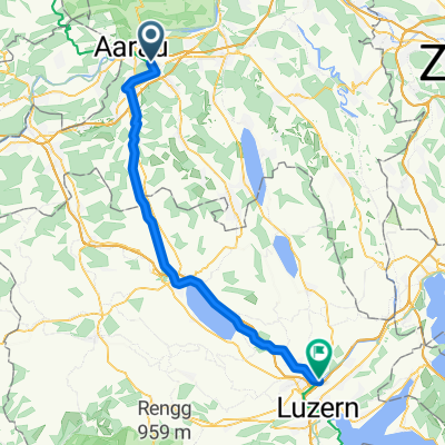
Rheinland-Route 2012
A cycling route starting in Suhr, Canton of Aargau, Switzerland.
Overview
About this route
- Day:
Suhr-Aarau-Laufenburg-Zurzach-Schaffhausen
- Day:
Schaffhausen-Stein am Rhein-Konstanz
- -:--
- Duration
- 148.7 km
- Distance
- 597 m
- Ascent
- 596 m
- Descent
- ---
- Avg. speed
- ---
- Max. altitude
Route quality
Waytypes & surfaces along the route
Waytypes
Quiet road
25.3 km
(17 %)
Road
13.4 km
(9 %)
Surfaces
Paved
129.4 km
(87 %)
Unpaved
5.9 km
(4 %)
Asphalt
129.4 km
(87 %)
Gravel
4.5 km
(3 %)
Continue with Bikemap
Use, edit, or download this cycling route
You would like to ride Rheinland-Route 2012 or customize it for your own trip? Here is what you can do with this Bikemap route:
Free features
- Save this route as favorite or in collections
- Copy & plan your own version of this route
- Split it into stages to create a multi-day tour
- Sync your route with Garmin or Wahoo
Premium features
Free trial for 3 days, or one-time payment. More about Bikemap Premium.
- Navigate this route on iOS & Android
- Export a GPX / KML file of this route
- Create your custom printout (try it for free)
- Download this route for offline navigation
Discover more Premium features.
Get Bikemap PremiumFrom our community
Other popular routes starting in Suhr
 Suhr - Brig
- Distance
- 211.6 km
- Ascent
- 5,844 m
- Descent
- 5,550 m
- Location
- Suhr, Canton of Aargau, Switzerland
 Sempachersee
- Distance
- 76 km
- Ascent
- 440 m
- Descent
- 438 m
- Location
- Suhr, Canton of Aargau, Switzerland
 Suhr AG - Emmen
- Distance
- 47 km
- Ascent
- 129 m
- Descent
- 0 m
- Location
- Suhr, Canton of Aargau, Switzerland
 Suhr - Homberg - Suhr
- Distance
- 44.5 km
- Ascent
- 614 m
- Descent
- 615 m
- Location
- Suhr, Canton of Aargau, Switzerland
 Geissflueh
- Distance
- 40.3 km
- Ascent
- 936 m
- Descent
- 936 m
- Location
- Suhr, Canton of Aargau, Switzerland
 Gränichen,Brugg, Döttingen, Schlatt, Veltheim, Auenstein, Suhr Gänichen
- Distance
- 72.5 km
- Ascent
- 429 m
- Descent
- 429 m
- Location
- Suhr, Canton of Aargau, Switzerland
 Helgenfeldweg 1, Suhr nach Muhenstrasse 6, Oberentfelden
- Distance
- 23.1 km
- Ascent
- 296 m
- Descent
- 278 m
- Location
- Suhr, Canton of Aargau, Switzerland
 Rheinland-Route 2012
- Distance
- 148.7 km
- Ascent
- 597 m
- Descent
- 596 m
- Location
- Suhr, Canton of Aargau, Switzerland
Open it in the app