
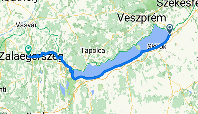
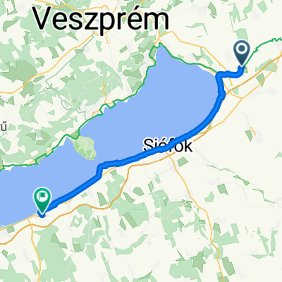
From Balatonvilágos to Zalaegerszeg
A cycling route starting in Lepsény, Fejér, Hungary.
Overview
About this route
- 8 h 28 min
- Duration
- 145.4 km
- Distance
- 849 m
- Ascent
- 844 m
- Descent
- 17.2 km/h
- Avg. speed
- 263 m
- Max. altitude
Route quality
Waytypes & surfaces along the route
Waytypes
Quiet road
40.7 km
(28 %)
Living street
32 km
(22 %)
Surfaces
Paved
119.2 km
(82 %)
Unpaved
2.9 km
(2 %)
Asphalt
119.2 km
(82 %)
Ground
2.9 km
(2 %)
Undefined
23.3 km
(16 %)
Continue with Bikemap
Use, edit, or download this cycling route
You would like to ride From Balatonvilágos to Zalaegerszeg or customize it for your own trip? Here is what you can do with this Bikemap route:
Free features
- Save this route as favorite or in collections
- Copy & plan your own version of this route
- Split it into stages to create a multi-day tour
- Sync your route with Garmin or Wahoo
Premium features
Free trial for 3 days, or one-time payment. More about Bikemap Premium.
- Navigate this route on iOS & Android
- Export a GPX / KML file of this route
- Create your custom printout (try it for free)
- Download this route for offline navigation
Discover more Premium features.
Get Bikemap PremiumFrom our community
Other popular routes starting in Lepsény
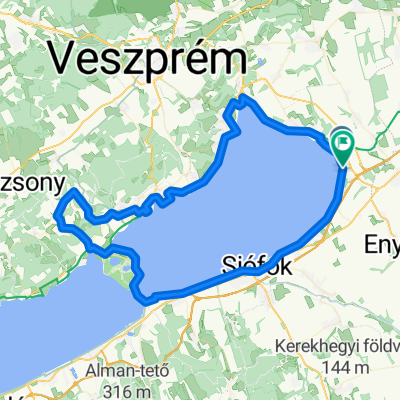 Balaton kiskör - 90
- Distance
- 95 km
- Ascent
- 499 m
- Descent
- 497 m
- Location
- Lepsény, Fejér, Hungary
 Balatonkör
- Distance
- 220 km
- Ascent
- 161 m
- Descent
- 161 m
- Location
- Lepsény, Fejér, Hungary
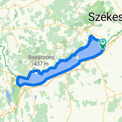
 kispelso
- Distance
- 78.2 km
- Ascent
- 205 m
- Descent
- 205 m
- Location
- Lepsény, Fejér, Hungary
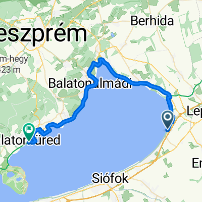 Hólyagos utazás
- Distance
- 41.3 km
- Ascent
- 204 m
- Descent
- 299 m
- Location
- Lepsény, Fejér, Hungary
 Balaton világos Táncsics Mihály utca 5
- Distance
- 205 km
- Ascent
- 676 m
- Descent
- 675 m
- Location
- Lepsény, Fejér, Hungary
 Csók István sétány - József Attila utca
- Distance
- 206.9 km
- Ascent
- 1,407 m
- Descent
- 1,474 m
- Location
- Lepsény, Fejér, Hungary
 Táncsics utca - Táncsics utca
- Distance
- 199.3 km
- Ascent
- 1,038 m
- Descent
- 1,106 m
- Location
- Lepsény, Fejér, Hungary
 Balatonberény - Gyenesdiás
- Distance
- 49.2 km
- Ascent
- 139 m
- Descent
- 162 m
- Location
- Lepsény, Fejér, Hungary
Open it in the app