
Wandern Hofcafe Hadermann
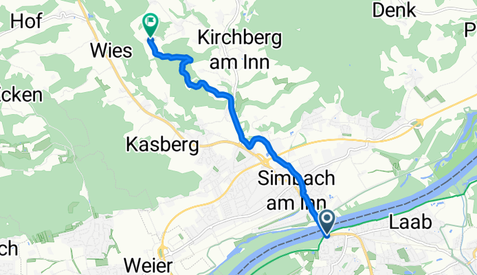
A cycling route starting in Braunau am Inn, Upper Austria, Austria.
Overview
About this route
20250221 1400
- 27 min
- Duration
- 5.6 km
- Distance
- 161 m
- Ascent
- 3 m
- Descent
- 12.5 km/h
- Avg. speed
- 505 m
- Max. altitude

Route highlights
Points of interest along the route

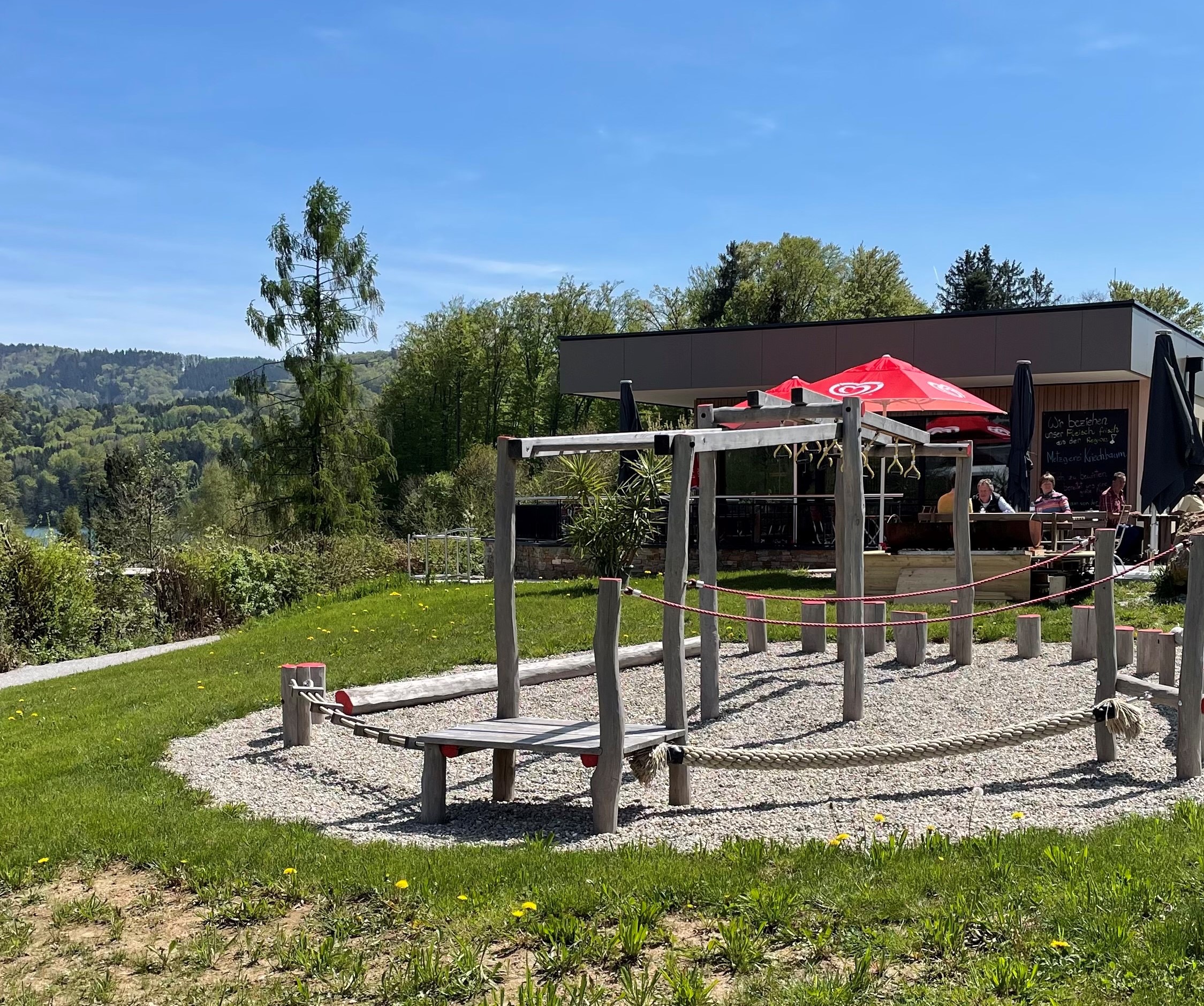
Point of interest after 5.6 km
Hofcafe Hadermann https://www.facebook.com/people/Hofcafé-Hadermann/100057074035736/
Continue with Bikemap
Use, edit, or download this cycling route
You would like to ride Wandern Hofcafe Hadermann or customize it for your own trip? Here is what you can do with this Bikemap route:
Free features
- Save this route as favorite or in collections
- Copy & plan your own version of this route
- Sync your route with Garmin or Wahoo
Premium features
Free trial for 3 days, or one-time payment. More about Bikemap Premium.
- Navigate this route on iOS & Android
- Export a GPX / KML file of this route
- Create your custom printout (try it for free)
- Download this route for offline navigation
Discover more Premium features.
Get Bikemap PremiumFrom our community
Other popular routes starting in Braunau am Inn
 2021-P01 Holzöster
- Distance
- 62.6 km
- Ascent
- 2,138 m
- Descent
- 2,138 m
- Location
- Braunau am Inn, Upper Austria, Austria
 2025-P02 Kirchweidach🇩🇪
- Distance
- 94.8 km
- Ascent
- 746 m
- Descent
- 744 m
- Location
- Braunau am Inn, Upper Austria, Austria
 2020-W14 Ach
- Distance
- 50.4 km
- Ascent
- 624 m
- Descent
- 628 m
- Location
- Braunau am Inn, Upper Austria, Austria
 Lange Radrunde durch Braunau am Inn
- Distance
- 57.5 km
- Ascent
- 415 m
- Descent
- 417 m
- Location
- Braunau am Inn, Upper Austria, Austria
 2025-P04 Mattsee
- Distance
- 75.7 km
- Ascent
- 729 m
- Descent
- 726 m
- Location
- Braunau am Inn, Upper Austria, Austria
 Wandern Hofcafe Hadermann
- Distance
- 5.6 km
- Ascent
- 161 m
- Descent
- 3 m
- Location
- Braunau am Inn, Upper Austria, Austria
 Lange Ausfahrt durch Braunau am Inn
- Distance
- 43.8 km
- Ascent
- 132 m
- Descent
- 133 m
- Location
- Braunau am Inn, Upper Austria, Austria
 Simbach Buchberg
- Distance
- 16.9 km
- Ascent
- 216 m
- Descent
- 215 m
- Location
- Braunau am Inn, Upper Austria, Austria
Open it in the app