

Elsass 4
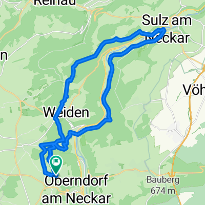
A cycling route starting in Oberndorf, Baden-Württemberg, Germany.
Overview
About this route
- 5 h 5 min
- Duration
- 80.7 km
- Distance
- 1,298 m
- Ascent
- 1,585 m
- Descent
- 15.9 km/h
- Avg. speed
- 679 m
- Avg. speed
Route quality
Waytypes & surfaces along the route
Waytypes
Track
34.3 km
(42 %)
Quiet road
28.7 km
(36 %)
Surfaces
Paved
67.9 km
(84 %)
Unpaved
6.9 km
(9 %)
Asphalt
62.1 km
(77 %)
Paved (undefined)
4.9 km
(6 %)
Continue with Bikemap
Use, edit, or download this cycling route
You would like to ride Elsass 4 or customize it for your own trip? Here is what you can do with this Bikemap route:
Free features
- Save this route as favorite or in collections
- Copy & plan your own version of this route
- Sync your route with Garmin or Wahoo
Premium features
Free trial for 3 days, or one-time payment. More about Bikemap Premium.
- Navigate this route on iOS & Android
- Export a GPX / KML file of this route
- Create your custom printout (try it for free)
- Download this route for offline navigation
Discover more Premium features.
Get Bikemap PremiumFrom our community
Other popular routes starting in Oberndorf
 Elsass 4
- Distance
- 80.7 km
- Ascent
- 1,298 m
- Descent
- 1,585 m
- Location
- Oberndorf, Baden-Württemberg, Germany
 Neckartal und Stausee Schömberg
- Distance
- 52.4 km
- Ascent
- 576 m
- Descent
- 588 m
- Location
- Oberndorf, Baden-Württemberg, Germany
 Bochingen Kloster Kirchberg
- Distance
- 27.6 km
- Ascent
- 357 m
- Descent
- 358 m
- Location
- Oberndorf, Baden-Württemberg, Germany
 Vatertagstour zur Struthütte
- Distance
- 57.4 km
- Ascent
- 405 m
- Descent
- 417 m
- Location
- Oberndorf, Baden-Württemberg, Germany
 Beff-Alp-Schil-Wolf-Horn-Fohr-Lang-Hardt-Maria-Flöz-Bös-Beff
- Distance
- 104 km
- Ascent
- 948 m
- Descent
- 948 m
- Location
- Oberndorf, Baden-Württemberg, Germany
 Lindenhof - Sulz
- Distance
- 25.7 km
- Ascent
- 340 m
- Descent
- 336 m
- Location
- Oberndorf, Baden-Württemberg, Germany
 Links und rechts vom oberen Neckartal
- Distance
- 54.9 km
- Ascent
- 787 m
- Descent
- 689 m
- Location
- Oberndorf, Baden-Württemberg, Germany
 Lindenhof-Dunningen
- Distance
- 38.2 km
- Ascent
- 210 m
- Descent
- 211 m
- Location
- Oberndorf, Baden-Württemberg, Germany
Open it in the app