

Home - Velencei-tó Csepelen kersztül
A cycling route starting in Gyál, Pest County, Hungary.
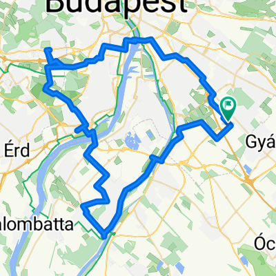
Overview
About this route
Próbáltam a legrövidebb utat megtalálni a Velencei-tóhoz a 18. kerületből, lehetőleg úgy, hogy ez ne legyen szabálytalan.
Nagyvonalakban az útvonal:
Nagykőrösi út - Gubacsi híd - Csepel - M0-ás híd - Nagytétényi út - Érd - Martonvásár - Baracska - Pettend - Velencei-tó(szabadstrand)
- -:--
- Duration
- 59.3 km
- Distance
- 148 m
- Ascent
- 168 m
- Descent
- ---
- Avg. speed
- ---
- Max. altitude

Route highlights
Points of interest along the route

Photo after 12.5 km
Kerékpárút

Photo after 22.5 km
Kerékpárút vége

Photo after 24.1 km
Kerékpározni tilos

Photo after 28.3 km
Kerékpározni tilos

Photo after 47.6 km
Kerékpárút

Photo after 48.7 km
Kerékpárút vége

Photo after 51.7 km
HASZNÁLHATÓ kerékpárút

Photo after 53.9 km
Kerékpárút vége
Continue with Bikemap
Use, edit, or download this cycling route
You would like to ride Home - Velencei-tó Csepelen kersztül or customize it for your own trip? Here is what you can do with this Bikemap route:
Free features
- Save this route as favorite or in collections
- Copy & plan your own version of this route
- Sync your route with Garmin or Wahoo
Premium features
Free trial for 3 days, or one-time payment. More about Bikemap Premium.
- Navigate this route on iOS & Android
- Export a GPX / KML file of this route
- Create your custom printout (try it for free)
- Download this route for offline navigation
Discover more Premium features.
Get Bikemap PremiumFrom our community
Other popular routes starting in Gyál
 A et K Akadémiára és vissza 2018.05.27.
- Distance
- 66 km
- Ascent
- 91 m
- Descent
- 91 m
- Location
- Gyál, Pest County, Hungary
 Budapest to Paris
- Distance
- 2,267.3 km
- Ascent
- 12,660 m
- Descent
- 12,728 m
- Location
- Gyál, Pest County, Hungary
 Home - Nagytarcsa
- Distance
- 57.3 km
- Ascent
- 225 m
- Descent
- 223 m
- Location
- Gyál, Pest County, Hungary
 Gyál - Felsőpakony 1
- Distance
- 14.5 km
- Ascent
- 22 m
- Descent
- 22 m
- Location
- Gyál, Pest County, Hungary
 Malacka
- Distance
- 22.2 km
- Ascent
- 30 m
- Descent
- 40 m
- Location
- Gyál, Pest County, Hungary
 Kincskereső túra 2016.05.01.
- Distance
- 77 km
- Ascent
- 162 m
- Descent
- 162 m
- Location
- Gyál, Pest County, Hungary
 Home - Velencei-tó Csepelen kersztül
- Distance
- 59.3 km
- Ascent
- 148 m
- Descent
- 168 m
- Location
- Gyál, Pest County, Hungary
 üllö Pécel Pest Futam
- Distance
- 60.9 km
- Ascent
- 151 m
- Descent
- 151 m
- Location
- Gyál, Pest County, Hungary
Open it in the app