

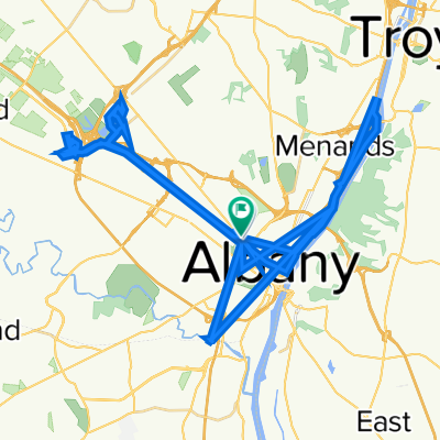
Route to Lockport
A cycling route starting in Albany, New York, United States.
Overview
About this route
- 31 h 42 min
- Duration
- 535.4 km
- Distance
- 2,824 m
- Ascent
- 2,688 m
- Descent
- 16.9 km/h
- Avg. speed
- 279 m
- Max. altitude

Route quality
Waytypes & surfaces along the route
Waytypes
Cycleway
227 km
(42 %)
Quiet road
198 km
(37 %)
Surfaces
Paved
262 km
(49 %)
Unpaved
87.2 km
(16 %)
Asphalt
242.8 km
(45 %)
Gravel
75.9 km
(14 %)
Continue with Bikemap
Use, edit, or download this cycling route
You would like to ride Route to Lockport or customize it for your own trip? Here is what you can do with this Bikemap route:
Free features
- Save this route as favorite or in collections
- Copy & plan your own version of this route
- Split it into stages to create a multi-day tour
- Sync your route with Garmin or Wahoo
Premium features
Free trial for 3 days, or one-time payment. More about Bikemap Premium.
- Navigate this route on iOS & Android
- Export a GPX / KML file of this route
- Create your custom printout (try it for free)
- Download this route for offline navigation
Discover more Premium features.
Get Bikemap PremiumFrom our community
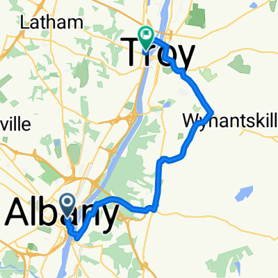
Other popular routes starting in Albany
 Route to Central Avenue 150, Albany
- Distance
- 71.1 km
- Ascent
- 284 m
- Descent
- 282 m
- Location
- Albany, New York, United States
 Albany, Ny - Watervlier, NY TT
- Distance
- 20.8 km
- Ascent
- 167 m
- Descent
- 180 m
- Location
- Albany, New York, United States
 Route to Lockport
- Distance
- 535.4 km
- Ascent
- 2,824 m
- Descent
- 2,688 m
- Location
- Albany, New York, United States
 corning preserve
- Distance
- 6.9 km
- Ascent
- 16 m
- Descent
- 12 m
- Location
- Albany, New York, United States
 Test 1
- Distance
- 299.7 km
- Ascent
- 2,273 m
- Descent
- 2,238 m
- Location
- Albany, New York, United States
 Albany to Port Henry, NY on Empire Rail Trail
- Distance
- 192.3 km
- Ascent
- 2,418 m
- Descent
- 2,369 m
- Location
- Albany, New York, United States
 24 Eagle St, Albany to 50 Neponset St, South Walpole
- Distance
- 278.1 km
- Ascent
- 3,843 m
- Descent
- 3,812 m
- Location
- Albany, New York, United States
 409 Madison Ave, Albany to 419 Madison Ave, Albany
- Distance
- 18.1 km
- Ascent
- 187 m
- Descent
- 186 m
- Location
- Albany, New York, United States
Open it in the app