

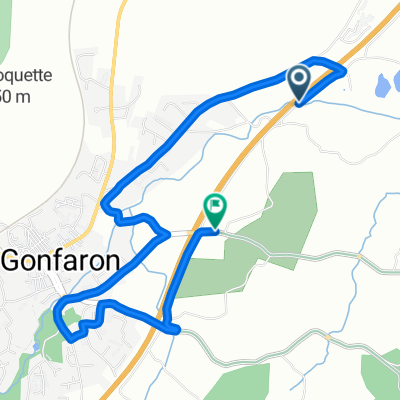
Route to Le Pradet
A cycling route starting in Gonfaron, Provence-Alpes-Côte d'Azur Region, France.
Overview
About this route
- 2 h 41 min
- Duration
- 45.1 km
- Distance
- 374 m
- Ascent
- 533 m
- Descent
- 16.8 km/h
- Avg. speed
- 250 m
- Max. altitude

Route quality
Waytypes & surfaces along the route
Waytypes
Road
19 km
(42 %)
Quiet road
18 km
(40 %)
Surfaces
Paved
18.5 km
(41 %)
Unpaved
1.4 km
(3 %)
Asphalt
18.5 km
(41 %)
Gravel
1.4 km
(3 %)
Undefined
25.3 km
(56 %)
Continue with Bikemap
Use, edit, or download this cycling route
You would like to ride Route to Le Pradet or customize it for your own trip? Here is what you can do with this Bikemap route:
Free features
- Save this route as favorite or in collections
- Copy & plan your own version of this route
- Sync your route with Garmin or Wahoo
Premium features
Free trial for 3 days, or one-time payment. More about Bikemap Premium.
- Navigate this route on iOS & Android
- Export a GPX / KML file of this route
- Create your custom printout (try it for free)
- Download this route for offline navigation
Discover more Premium features.
Get Bikemap PremiumFrom our community
Other popular routes starting in Gonfaron
 Col de Fourche - Grimaud
- Distance
- 25.5 km
- Ascent
- 935 m
- Descent
- 1,153 m
- Location
- Gonfaron, Provence-Alpes-Côte d'Azur Region, France

2713®
Gonfaron Cycling- Distance
- 25.4 km
- Ascent
- 36 m
- Descent
- 715 m
- Location
- Gonfaron, Provence-Alpes-Côte d'Azur Region, France
 ETAPE 5 GONFARON - LA VOIE ROYALE
- Distance
- 23.1 km
- Ascent
- 650 m
- Descent
- 650 m
- Location
- Gonfaron, Provence-Alpes-Côte d'Azur Region, France
 La ''Ste Brigitte'' * - Vidauban - 12 juin 16
- Distance
- 174.3 km
- Ascent
- 1,585 m
- Descent
- 1,584 m
- Location
- Gonfaron, Provence-Alpes-Côte d'Azur Region, France
 ETAPE 3 GONFARON - LES FOURCHES
- Distance
- 23.2 km
- Ascent
- 670 m
- Descent
- 675 m
- Location
- Gonfaron, Provence-Alpes-Côte d'Azur Region, France
 13 Avenue Jean Aicard, Gonfaron nach Le Vieux Cannet, Le Cannet-des-Maures
- Distance
- 13.9 km
- Ascent
- 166 m
- Descent
- 90 m
- Location
- Gonfaron, Provence-Alpes-Côte d'Azur Region, France
 Chemin du Gué, Gonfaron à Route des Mayons, Gonfaron
- Distance
- 5.3 km
- Ascent
- 229 m
- Descent
- 202 m
- Location
- Gonfaron, Provence-Alpes-Côte d'Azur Region, France
 Route to Le Pradet
- Distance
- 45.1 km
- Ascent
- 374 m
- Descent
- 533 m
- Location
- Gonfaron, Provence-Alpes-Côte d'Azur Region, France
Open it in the app