

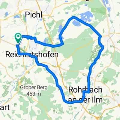
Karlskron-Rohrbach-Geisenfeld-Karlskron
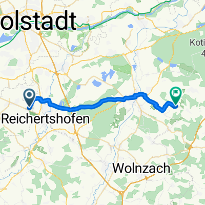
A cycling route starting in Baar-Ebenhausen, Bavaria, Germany.
Overview
About this route
Training route particularly suitable for road cycling.
I preferred low traffic roads.
On the section between Geisenfeld and Forstwiesen there is more traffic, but next to the road there is a well-developed bike path.
- -:--
- Duration
- 43.2 km
- Distance
- 197 m
- Ascent
- 194 m
- Descent
- ---
- Avg. speed
- 459 m
- Max. altitude
Route quality
Waytypes & surfaces along the route
Waytypes
Quiet road
21.6 km
(50 %)
Road
10.8 km
(25 %)
Surfaces
Paved
33.7 km
(78 %)
Unpaved
0.4 km
(1 %)
Asphalt
32.4 km
(75 %)
Paved (undefined)
1.3 km
(3 %)
Continue with Bikemap
Use, edit, or download this cycling route
You would like to ride Karlskron-Rohrbach-Geisenfeld-Karlskron or customize it for your own trip? Here is what you can do with this Bikemap route:
Free features
- Save this route as favorite or in collections
- Copy & plan your own version of this route
- Sync your route with Garmin or Wahoo
Premium features
Free trial for 3 days, or one-time payment. More about Bikemap Premium.
- Navigate this route on iOS & Android
- Export a GPX / KML file of this route
- Create your custom printout (try it for free)
- Download this route for offline navigation
Discover more Premium features.
Get Bikemap PremiumFrom our community
Other popular routes starting in Baar-Ebenhausen
 Baar-Ebenhausen-Weichering
- Distance
- 62.4 km
- Ascent
- 206 m
- Descent
- 204 m
- Location
- Baar-Ebenhausen, Bavaria, Germany
 Karlskron-Hohenwart-Mitterscheyern-Tegernbach-Reichertshofen
- Distance
- 56.4 km
- Ascent
- 452 m
- Descent
- 435 m
- Location
- Baar-Ebenhausen, Bavaria, Germany
 2011_Baar_Schrobenhausen
- Distance
- 30 km
- Ascent
- 161 m
- Descent
- 121 m
- Location
- Baar-Ebenhausen, Bavaria, Germany
 Karlskron - Biergarten Unterpindhart
- Distance
- 22.1 km
- Ascent
- 61 m
- Descent
- 42 m
- Location
- Baar-Ebenhausen, Bavaria, Germany
 Vatertagsrunde
- Distance
- 32.1 km
- Ascent
- 40 m
- Descent
- 39 m
- Location
- Baar-Ebenhausen, Bavaria, Germany
 Ebenhausen-Schrobenhausen-Pfaffenhofen-Geisenfeld-Ebenhausen
- Distance
- 82.6 km
- Ascent
- 261 m
- Descent
- 258 m
- Location
- Baar-Ebenhausen, Bavaria, Germany
 Doppelberg Hoheried-Freienhausen
- Distance
- 55.3 km
- Ascent
- 349 m
- Descent
- 341 m
- Location
- Baar-Ebenhausen, Bavaria, Germany
 Karlskron-Rohrbach-Geisenfeld-Karlskron
- Distance
- 43.2 km
- Ascent
- 197 m
- Descent
- 194 m
- Location
- Baar-Ebenhausen, Bavaria, Germany
Open it in the app