

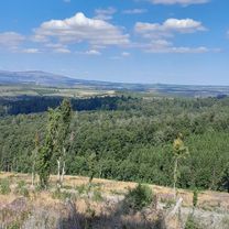
2025_Harz_Tanne-Wurmberg_57-1200
A cycling route starting in Benneckenstein, Saxony-Anhalt, Germany.
Overview
About this route
- 4 h 37 min
- Duration
- 56.5 km
- Distance
- 1,163 m
- Ascent
- 1,164 m
- Descent
- 12.2 km/h
- Avg. speed
- 962 m
- Max. altitude

Route quality
Waytypes & surfaces along the route
Waytypes
Track
45.2 km
(80 %)
Path
6.8 km
(12 %)
Surfaces
Paved
5.1 km
(9 %)
Unpaved
44.6 km
(79 %)
Gravel
28.3 km
(50 %)
Ground
10.7 km
(19 %)
Continue with Bikemap
Use, edit, or download this cycling route
You would like to ride 2025_Harz_Tanne-Wurmberg_57-1200 or customize it for your own trip? Here is what you can do with this Bikemap route:
Free features
- Save this route as favorite or in collections
- Copy & plan your own version of this route
- Sync your route with Garmin or Wahoo
Premium features
Free trial for 3 days, or one-time payment. More about Bikemap Premium.
- Navigate this route on iOS & Android
- Export a GPX / KML file of this route
- Create your custom printout (try it for free)
- Download this route for offline navigation
Discover more Premium features.
Get Bikemap PremiumFrom our community
Other popular routes starting in Benneckenstein
 2025_Harz_Tanne-Wurmberg_57-1200
- Distance
- 56.5 km
- Ascent
- 1,163 m
- Descent
- 1,164 m
- Location
- Benneckenstein, Saxony-Anhalt, Germany
 Harz Tour 3. Tag - Sonntag
- Distance
- 127.3 km
- Ascent
- 1,872 m
- Descent
- 1,838 m
- Location
- Benneckenstein, Saxony-Anhalt, Germany
 Harz eher flache Strecke
- Distance
- 90.4 km
- Ascent
- 943 m
- Descent
- 943 m
- Location
- Benneckenstein, Saxony-Anhalt, Germany
 Harzer Roller
- Distance
- 158.9 km
- Ascent
- 1,257 m
- Descent
- 1,275 m
- Location
- Benneckenstein, Saxony-Anhalt, Germany
 Entspannte Route
- Distance
- 11.5 km
- Ascent
- 200 m
- Descent
- 157 m
- Location
- Benneckenstein, Saxony-Anhalt, Germany
 2025_Harz_Tanne_Wurmberg_58_1100
- Distance
- 58.2 km
- Ascent
- 989 m
- Descent
- 1,019 m
- Location
- Benneckenstein, Saxony-Anhalt, Germany
 Grenzerfahrungen Teil 08 #BETA#
- Distance
- 55.9 km
- Ascent
- 756 m
- Descent
- 1,249 m
- Location
- Benneckenstein, Saxony-Anhalt, Germany
 Hohegeiß - Bag Lauterberg - Braunlage - Hohegeiß 68 km 840HM
- Distance
- 68.1 km
- Ascent
- 682 m
- Descent
- 676 m
- Location
- Benneckenstein, Saxony-Anhalt, Germany
Open it in the app