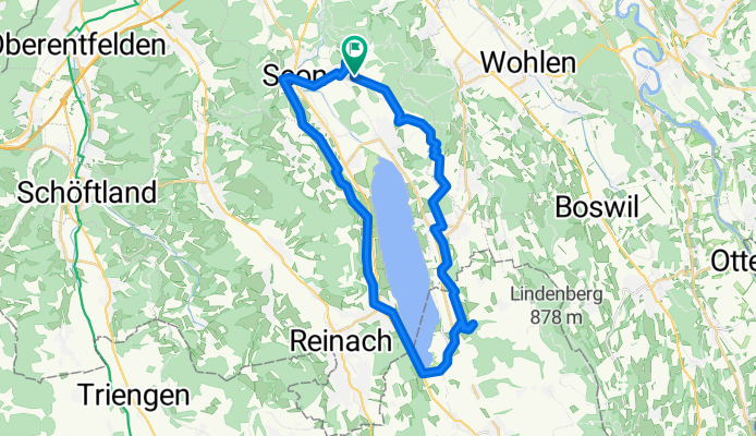
Mit der Apple Watch am 10. Mai, 16:18 aufgenommen
A cycling route starting in Egliswil, Canton of Aargau, Switzerland.
Overview
About this route
- 1 h 56 min
- Duration
- 37.1 km
- Distance
- 733 m
- Ascent
- 733 m
- Descent
- 19.1 km/h
- Avg. speed
- 632 m
- Avg. speed
Route photos
Route quality
Waytypes & surfaces along the route
Waytypes
Track
14.6 km
(39 %)
Quiet road
10.7 km
(29 %)
Surfaces
Paved
5.9 km
(16 %)
Unpaved
10.4 km
(28 %)
Gravel
7.4 km
(20 %)
Asphalt
4.9 km
(13 %)
Continue with Bikemap
Use, edit, or download this cycling route
You would like to ride Mit der Apple Watch am 10. Mai, 16:18 aufgenommen or customize it for your own trip? Here is what you can do with this Bikemap route:
Free features
- Save this route as favorite or in collections
- Copy & plan your own version of this route
- Sync your route with Garmin or Wahoo
Premium features
Free trial for 3 days, or one-time payment. More about Bikemap Premium.
- Navigate this route on iOS & Android
- Export a GPX / KML file of this route
- Create your custom printout (try it for free)
- Download this route for offline navigation
Discover more Premium features.
Get Bikemap PremiumFrom our community
Other popular routes starting in Egliswil
- Häbnistrasse 1–7, Egliswil nach Dorfstrasse 22, Würenlos
- Distance
- 28.3 km
- Ascent
- 483 m
- Descent
- 531 m
- Location
- Egliswil, Canton of Aargau, Switzerland
- Häbnistrasse 5, Egliswil nach Fluhbachstrasse 3, Uerkheim
- Distance
- 22.2 km
- Ascent
- 486 m
- Descent
- 487 m
- Location
- Egliswil, Canton of Aargau, Switzerland
- Mit der Apple Watch am 10. Mai, 16:18 aufgenommen
- Distance
- 37.1 km
- Ascent
- 733 m
- Descent
- 733 m
- Location
- Egliswil, Canton of Aargau, Switzerland
- Wiederhergestellte Route
- Distance
- 46.2 km
- Ascent
- 607 m
- Descent
- 627 m
- Location
- Egliswil, Canton of Aargau, Switzerland
- esterli 5weiher
- Distance
- 2.1 km
- Ascent
- 3 m
- Descent
- 128 m
- Location
- Egliswil, Canton of Aargau, Switzerland
- Egliswil, Holderbank, Schinznach Bad, Birr, Häggligen, Seengen
- Distance
- 41.2 km
- Ascent
- 742 m
- Descent
- 740 m
- Location
- Egliswil, Canton of Aargau, Switzerland
- Engestrasse, Egliswil nach Engestrasse, Egliswil
- Distance
- 27.2 km
- Ascent
- 779 m
- Descent
- 779 m
- Location
- Egliswil, Canton of Aargau, Switzerland
- Esterliturm
- Distance
- 2.3 km
- Ascent
- 30 m
- Descent
- 168 m
- Location
- Egliswil, Canton of Aargau, Switzerland