

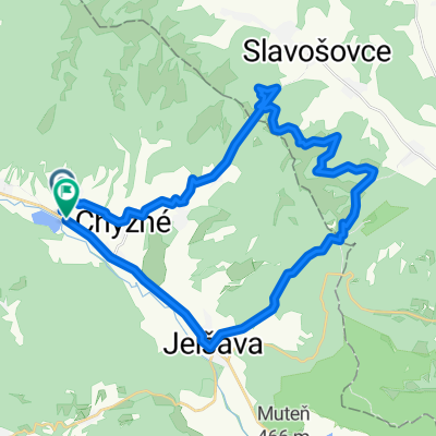
Revúca-Telgárt- Dobš. Jask.- Hansjakubová rybník
A cycling route starting in Revúca, Banská Bystrica Region, Slovakia.
Overview
About this route
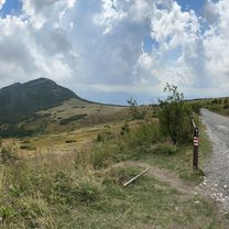
Asfalt - cesty, polne / lesne cesty
- -:--
- Duration
- 42.4 km
- Distance
- 1,572 m
- Ascent
- 1,024 m
- Descent
- ---
- Avg. speed
- 1,196 m
- Max. altitude

Continue with Bikemap
Use, edit, or download this cycling route
You would like to ride Revúca-Telgárt- Dobš. Jask.- Hansjakubová rybník or customize it for your own trip? Here is what you can do with this Bikemap route:
Free features
- Save this route as favorite or in collections
- Copy & plan your own version of this route
- Sync your route with Garmin or Wahoo
Premium features
Free trial for 3 days, or one-time payment. More about Bikemap Premium.
- Navigate this route on iOS & Android
- Export a GPX / KML file of this route
- Create your custom printout (try it for free)
- Download this route for offline navigation
Discover more Premium features.
Get Bikemap PremiumFrom our community
Other popular routes starting in Revúca
 SLOVAKIA 2009.07.12. Királyhegy
- Distance
- 5.6 km
- Ascent
- 1,056 m
- Descent
- 5 m
- Location
- Revúca, Banská Bystrica Region, Slovakia
 Kráľova Hoľa
- Distance
- 12 km
- Ascent
- 1,194 m
- Descent
- 75 m
- Location
- Revúca, Banská Bystrica Region, Slovakia
 Juraja Kriváňa, Šumiac až Bučinka, Šumiac
- Distance
- 31.6 km
- Ascent
- 1,235 m
- Descent
- 1,240 m
- Location
- Revúca, Banská Bystrica Region, Slovakia
 Šumiac do Šumiac
- Distance
- 34.1 km
- Ascent
- 1,019 m
- Descent
- 1,019 m
- Location
- Revúca, Banská Bystrica Region, Slovakia
 Slavosovsky tunel - Chyzne
- Distance
- 10.7 km
- Ascent
- 241 m
- Descent
- 354 m
- Location
- Revúca, Banská Bystrica Region, Slovakia
 Revúca-M.Zdychava- Sev. Lúka- Č.Skala - Pr.Hora
- Distance
- 47.4 km
- Ascent
- 1,563 m
- Descent
- 1,563 m
- Location
- Revúca, Banská Bystrica Region, Slovakia
 Revúca-Telgárt- Dobš. Jask.- Hansjakubová rybník
- Distance
- 42.4 km
- Ascent
- 1,572 m
- Descent
- 1,024 m
- Location
- Revúca, Banská Bystrica Region, Slovakia
 Trasa z Revúcka Lehota do Parkovisko
- Distance
- 34.6 km
- Ascent
- 1,005 m
- Descent
- 1,007 m
- Location
- Revúca, Banská Bystrica Region, Slovakia
Open it in the app