
Elogio del passaggio a livello sulla Provinciale Buronzina
A cycling route starting in Rovasenda, Piedmont, Italy.
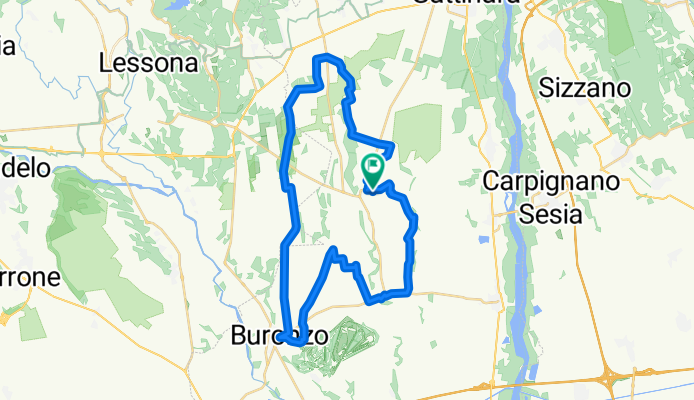
Overview
About this route
The level crossing in question is located roughly halfway along the Sp 63/316, known as 'Buronzina', which connects Buronzo to the Sp 317. The route travels the entire length, passing through rice fields and almost total tranquility. This tranquility actually characterizes the entire route, which mostly winds between one farmhouse and another. It is precisely the farmhouse signs that act as a compass for correct 'navigation' in this land on the border between rice paddies and patches of heath, at the foot of the Biella Alps.
The cycling is on flat terrain, half on asphalt and half on good gravel roads. A touch of adrenaline is provided by the ford over the Torrente Rovasenda which, although not difficult under normal conditions, is best crossed with the bike in hand: a foot bath is preferable to a fall.
Rovasenda – Sp 66 – Cascine Minusiera, Belvedere, Boschetti Lunghi, Salera, Cascinetta, Sant’Alfonso, Galoppa, Rosa, Speranza – Sp 61 – San Giacomo – Buronzo – Sp 63/316 'Buronzina' – Level crossing – gravel path between forest and rice fields – Sp 318 – Cascina Derna – crossing Sp 64 – Cascina Pubione – ford over Torrente Rovasenda – Baragge Nature Reserve – Cascine Maddalena and Maria – crossing Sp 3 – disused Arona–Santhià railway – Cascina dell’Angelo – Rovasenda.
Railway station at Rovasenda.
- 2 h 43 min
- Duration
- 43 km
- Distance
- 117 m
- Ascent
- 116 m
- Descent
- 15.8 km/h
- Avg. speed
- 266 m
- Max. altitude

Route quality
Waytypes & surfaces along the route
Waytypes
Track
15.5 km
(36 %)
Quiet road
12.5 km
(29 %)
Surfaces
Paved
8.2 km
(19 %)
Unpaved
4.7 km
(11 %)
Asphalt
5.6 km
(13 %)
Paved (undefined)
2.6 km
(6 %)
Continue with Bikemap
Use, edit, or download this cycling route
You would like to ride Elogio del passaggio a livello sulla Provinciale Buronzina or customize it for your own trip? Here is what you can do with this Bikemap route:
Free features
- Save this route as favorite or in collections
- Copy & plan your own version of this route
- Sync your route with Garmin or Wahoo
Premium features
Free trial for 3 days, or one-time payment. More about Bikemap Premium.
- Navigate this route on iOS & Android
- Export a GPX / KML file of this route
- Create your custom printout (try it for free)
- Download this route for offline navigation
Discover more Premium features.
Get Bikemap PremiumFrom our community
Other popular routes starting in Rovasenda
 Da Via Per Rovasenda 3, Lenta a Corso Valsesia 120, Gattinara
- Distance
- 12.5 km
- Ascent
- 108 m
- Descent
- 73 m
- Location
- Rovasenda, Piedmont, Italy
 Da Via Lenta, Rovasenda a Via Alessandro Manzoni 3–26, Gattinara
- Distance
- 9.7 km
- Ascent
- 56 m
- Descent
- 22 m
- Location
- Rovasenda, Piedmont, Italy
 Elogio del passaggio a livello sulla Provinciale Buronzina
- Distance
- 43 km
- Ascent
- 117 m
- Descent
- 116 m
- Location
- Rovasenda, Piedmont, Italy
 PL2013 - #16 Rovasenda - Verolengo
- Distance
- 66.5 km
- Ascent
- 60 m
- Descent
- 105 m
- Location
- Rovasenda, Piedmont, Italy
 Elogio del passaggio a livello sulla Provinciale Buronzina
- Distance
- 38.6 km
- Ascent
- 96 m
- Descent
- 94 m
- Location
- Rovasenda, Piedmont, Italy
 Stage 13 of 26 Rovasenda - Alba 145km
- Distance
- 145.1 km
- Ascent
- 222 m
- Descent
- 287 m
- Location
- Rovasenda, Piedmont, Italy
 Baraggia Rovasenda
- Distance
- 18.4 km
- Ascent
- 109 m
- Descent
- 107 m
- Location
- Rovasenda, Piedmont, Italy
Open it in the app