
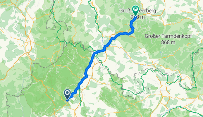
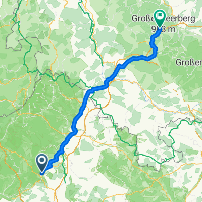
Bad Kissingen / Oberhof Etappe 4
A cycling route starting in Bad Kissingen, Bavaria, Germany.
Overview
About this route
- 5 h 46 min
- Duration
- 95.5 km
- Distance
- 1,315 m
- Ascent
- 719 m
- Descent
- 16.6 km/h
- Avg. speed
- 830 m
- Max. altitude
Route quality
Waytypes & surfaces along the route
Waytypes
Quiet road
22.9 km
(24 %)
Path
22 km
(23 %)
Surfaces
Paved
74.5 km
(78 %)
Unpaved
3.8 km
(4 %)
Asphalt
72.6 km
(76 %)
Paved (undefined)
1.9 km
(2 %)
Route highlights
Points of interest along the route
Point of interest after 61.1 km
Grenze DDR
Continue with Bikemap
Use, edit, or download this cycling route
You would like to ride Bad Kissingen / Oberhof Etappe 4 or customize it for your own trip? Here is what you can do with this Bikemap route:
Free features
- Save this route as favorite or in collections
- Copy & plan your own version of this route
- Split it into stages to create a multi-day tour
- Sync your route with Garmin or Wahoo
Premium features
Free trial for 3 days, or one-time payment. More about Bikemap Premium.
- Navigate this route on iOS & Android
- Export a GPX / KML file of this route
- Create your custom printout (try it for free)
- Download this route for offline navigation
Discover more Premium features.
Get Bikemap PremiumFrom our community
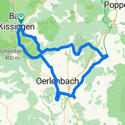
Other popular routes starting in Bad Kissingen
 Rundweg Bad Bocklet Nüdlingen
- Distance
- 22.9 km
- Ascent
- 351 m
- Descent
- 343 m
- Location
- Bad Kissingen, Bavaria, Germany
 Freitag
- Distance
- 33.4 km
- Ascent
- 366 m
- Descent
- 366 m
- Location
- Bad Kissingen, Bavaria, Germany
 Bad Kissingen / Oberhof Etappe 4
- Distance
- 95.5 km
- Ascent
- 1,315 m
- Descent
- 719 m
- Location
- Bad Kissingen, Bavaria, Germany
 Radwanderweg Vom Main zur Rhön Etappe 2
- Distance
- 58.5 km
- Ascent
- 325 m
- Descent
- 263 m
- Location
- Bad Kissingen, Bavaria, Germany
 25.04.21 Aura
- Distance
- 26.1 km
- Ascent
- 409 m
- Descent
- 416 m
- Location
- Bad Kissingen, Bavaria, Germany
 Scheffelstraße 5, Bad Kissingen nach Im Steinbusch 26, Bad Kissingen
- Distance
- 15 km
- Ascent
- 32 m
- Descent
- 67 m
- Location
- Bad Kissingen, Bavaria, Germany
 Rund_Um_Bad_Kissingen
- Distance
- 39.7 km
- Ascent
- 708 m
- Descent
- 695 m
- Location
- Bad Kissingen, Bavaria, Germany
 BK-Basaltsäulen Gangolfsberg-BK
- Distance
- 100.7 km
- Ascent
- 444 m
- Descent
- 496 m
- Location
- Bad Kissingen, Bavaria, Germany
Open it in the app