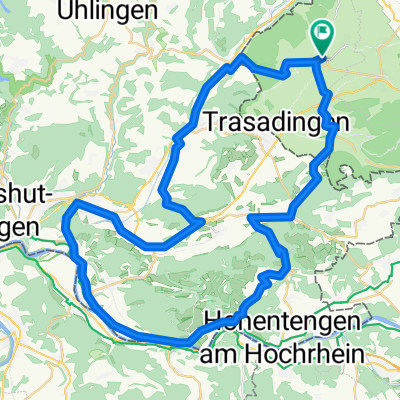
004 Südschwarzwaldrundfahrt
A cycling route starting in Hallau, Canton of Schaffhausen, Switzerland.
Overview
About this route
challenging route in the Southern Black Forest. Recommendation for experienced cyclists
- -:--
- Duration
- 65.9 km
- Distance
- 943 m
- Ascent
- 943 m
- Descent
- ---
- Avg. speed
- ---
- Max. altitude
Route quality
Waytypes & surfaces along the route
Waytypes
Road
19.1 km
(29 %)
Quiet road
8.6 km
(13 %)
Surfaces
Paved
38.9 km
(59 %)
Unpaved
0.7 km
(1 %)
Asphalt
38.9 km
(59 %)
Gravel
0.7 km
(1 %)
Undefined
26.4 km
(40 %)
Continue with Bikemap
Use, edit, or download this cycling route
You would like to ride 004 Südschwarzwaldrundfahrt or customize it for your own trip? Here is what you can do with this Bikemap route:
Free features
- Save this route as favorite or in collections
- Copy & plan your own version of this route
- Sync your route with Garmin or Wahoo
Premium features
Free trial for 3 days, or one-time payment. More about Bikemap Premium.
- Navigate this route on iOS & Android
- Export a GPX / KML file of this route
- Create your custom printout (try it for free)
- Download this route for offline navigation
Discover more Premium features.
Get Bikemap PremiumFrom our community
Other popular routes starting in Hallau
Eberfingen - Hallauer Berg, 579m- Distance
- 2.9 km
- Ascent
- 154 m
- Descent
- 14 m
- Location
- Hallau, Canton of Schaffhausen, Switzerland
Hallau - Dettighofer - Hallau- Distance
- 42.6 km
- Ascent
- 275 m
- Descent
- 275 m
- Location
- Hallau, Canton of Schaffhausen, Switzerland
Hallau - Schluchsee - Bonndorf - Eberfingen - Hallau- Distance
- 72.7 km
- Ascent
- 1,286 m
- Descent
- 1,286 m
- Location
- Hallau, Canton of Schaffhausen, Switzerland
Räbhüüslifest- Distance
- 17.4 km
- Ascent
- 254 m
- Descent
- 245 m
- Location
- Hallau, Canton of Schaffhausen, Switzerland
002 Brenden-Rothaus-Bonndorf-Stühlingen- Distance
- 80.8 km
- Ascent
- 1,508 m
- Descent
- 1,508 m
- Location
- Hallau, Canton of Schaffhausen, Switzerland
Hallau - Hohentengen - Zurzach- Distance
- 66.2 km
- Ascent
- 623 m
- Descent
- 621 m
- Location
- Hallau, Canton of Schaffhausen, Switzerland
Côte Wunderklingen- Distance
- 2.7 km
- Ascent
- 139 m
- Descent
- 0 m
- Location
- Hallau, Canton of Schaffhausen, Switzerland
Untere Alp (von Egg.-Bf.)- Distance
- 7.9 km
- Ascent
- 319 m
- Descent
- 0 m
- Location
- Hallau, Canton of Schaffhausen, Switzerland
Open it in the app


