

Nationalpark Seewinkel - Kurze Version
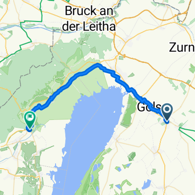
A cycling route starting in Mönchhof, Burgenland, Austria.
Overview
About this route
Short tour through the Seewinkel National Park. You ride through beautiful natural areas and past some magnificent holiday resorts, with countless heurigen and restaurants for culinary breaks.
A small section near Zicksee (about 200m) should be walked with your road bike, as it is a gravel path. Otherwise, the path is exclusively asphalt.
- -:--
- Duration
- 55.1 km
- Distance
- 21 m
- Ascent
- 23 m
- Descent
- ---
- Avg. speed
- ---
- Max. altitude
Route quality
Waytypes & surfaces along the route
Waytypes
Track
15.4 km
(28 %)
Quiet road
11 km
(20 %)
Surfaces
Paved
50.7 km
(92 %)
Unpaved
1.1 km
(2 %)
Asphalt
50.2 km
(91 %)
Gravel
1.1 km
(2 %)
Continue with Bikemap
Use, edit, or download this cycling route
You would like to ride Nationalpark Seewinkel - Kurze Version or customize it for your own trip? Here is what you can do with this Bikemap route:
Free features
- Save this route as favorite or in collections
- Copy & plan your own version of this route
- Sync your route with Garmin or Wahoo
Premium features
Free trial for 3 days, or one-time payment. More about Bikemap Premium.
- Navigate this route on iOS & Android
- Export a GPX / KML file of this route
- Create your custom printout (try it for free)
- Download this route for offline navigation
Discover more Premium features.
Get Bikemap PremiumFrom our community
Other popular routes starting in Mönchhof
 11-05-25
- Distance
- 41.3 km
- Ascent
- 29 m
- Descent
- 26 m
- Location
- Mönchhof, Burgenland, Austria
 Hansag-Radweg
- Distance
- 52 km
- Ascent
- 53 m
- Descent
- 53 m
- Location
- Mönchhof, Burgenland, Austria
 RCO 2017 Seewinkel 3.Tag
- Distance
- 80.4 km
- Ascent
- 205 m
- Descent
- 184 m
- Location
- Mönchhof, Burgenland, Austria
 Nationalpark Seewinkel - Mittellange Version
- Distance
- 71.8 km
- Ascent
- 30 m
- Descent
- 30 m
- Location
- Mönchhof, Burgenland, Austria
 Nationalpark Seewinkel - Mittellange Version
- Distance
- 71.8 km
- Ascent
- 10 m
- Descent
- 13 m
- Location
- Mönchhof, Burgenland, Austria
 Mönchhof bis Donnerskirchen - Esterhazy
- Distance
- 36.4 km
- Ascent
- 85 m
- Descent
- 88 m
- Location
- Mönchhof, Burgenland, Austria
 Első Fertő-tó kör második nap
- Distance
- 64.7 km
- Ascent
- 189 m
- Descent
- 140 m
- Location
- Mönchhof, Burgenland, Austria
 Stiftsgasse 2, Mönchhof nach Neusiedler Straße 2, Podersdorf am See
- Distance
- 11.2 km
- Ascent
- 38 m
- Descent
- 47 m
- Location
- Mönchhof, Burgenland, Austria
Open it in the app