

GPX Download: Kampenwand-Umrundung (MTB-Tour: 3) – Chiemgauer Alpen
A cycling route starting in Aschau im Chiemgau, Bavaria, Germany.
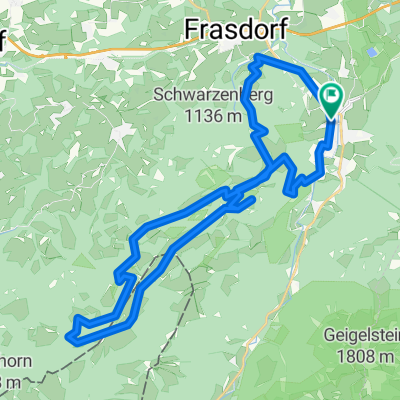
Overview
About this route
- 7 h 50 min
- Duration
- 84.5 km
- Distance
- 4,639 m
- Ascent
- 4,250 m
- Descent
- 10.8 km/h
- Avg. speed
- 1,214 m
- Max. altitude

Route quality
Waytypes & surfaces along the route
Waytypes
Track
4 km
(5 %)
Quiet road
0.6 km
(<1 %)
Undefined
80 km
(95 %)
Surfaces
Paved
0.7 km
(<1 %)
Unpaved
3.9 km
(5 %)
Gravel
1.9 km
(2 %)
Loose gravel
1.3 km
(2 %)
Continue with Bikemap
Use, edit, or download this cycling route
You would like to ride GPX Download: Kampenwand-Umrundung (MTB-Tour: 3) – Chiemgauer Alpen or customize it for your own trip? Here is what you can do with this Bikemap route:
Free features
- Save this route as favorite or in collections
- Copy & plan your own version of this route
- Split it into stages to create a multi-day tour
- Sync your route with Garmin or Wahoo
Premium features
Free trial for 3 days, or one-time payment. More about Bikemap Premium.
- Navigate this route on iOS & Android
- Export a GPX / KML file of this route
- Create your custom printout (try it for free)
- Download this route for offline navigation
Discover more Premium features.
Get Bikemap PremiumFrom our community
Other popular routes starting in Aschau im Chiemgau
 GPX Download: Kampenwand-Umrundung (MTB-Tour: 3) – Chiemgauer Alpen
- Distance
- 84.5 km
- Ascent
- 4,639 m
- Descent
- 4,250 m
- Location
- Aschau im Chiemgau, Bavaria, Germany
 aschau loop
- Distance
- 14.8 km
- Ascent
- 495 m
- Descent
- 490 m
- Location
- Aschau im Chiemgau, Bavaria, Germany
 Transalp 2018
- Distance
- 500.6 km
- Ascent
- 5,688 m
- Descent
- 6,242 m
- Location
- Aschau im Chiemgau, Bavaria, Germany
 Schachenberg
- Distance
- 4.4 km
- Ascent
- 379 m
- Descent
- 376 m
- Location
- Aschau im Chiemgau, Bavaria, Germany
 Kampenwand
- Distance
- 16.9 km
- Ascent
- 969 m
- Descent
- 970 m
- Location
- Aschau im Chiemgau, Bavaria, Germany
 Chiemgau: Frasdorf-Hochries
- Distance
- 34.9 km
- Ascent
- 1,180 m
- Descent
- 1,180 m
- Location
- Aschau im Chiemgau, Bavaria, Germany
 Kampenwand
- Distance
- 8 km
- Ascent
- 884 m
- Descent
- 77 m
- Location
- Aschau im Chiemgau, Bavaria, Germany
 Hochries Umrundung
- Distance
- 36.1 km
- Ascent
- 1,229 m
- Descent
- 1,229 m
- Location
- Aschau im Chiemgau, Bavaria, Germany
Open it in the app