

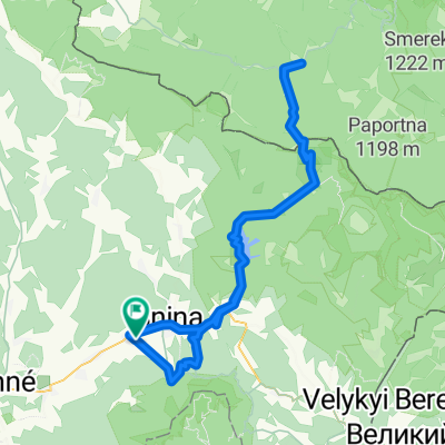
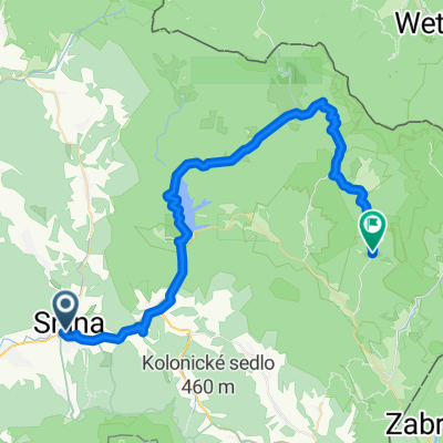
Snina- Dlhé n. Cir.- Kamenica n.Cir.- Humenné
A cycling route starting in Snina, Prešov Region, Slovakia.
Overview
About this route
Asphalt - roads
- 1 h 18 min
- Duration
- 21.6 km
- Distance
- 48 m
- Ascent
- 112 m
- Descent
- 16.7 km/h
- Avg. speed
- 216 m
- Max. altitude

Continue with Bikemap
Use, edit, or download this cycling route
You would like to ride Snina- Dlhé n. Cir.- Kamenica n.Cir.- Humenné or customize it for your own trip? Here is what you can do with this Bikemap route:
Free features
- Save this route as favorite or in collections
- Copy & plan your own version of this route
- Sync your route with Garmin or Wahoo
Premium features
Free trial for 3 days, or one-time payment. More about Bikemap Premium.
- Navigate this route on iOS & Android
- Export a GPX / KML file of this route
- Create your custom printout (try it for free)
- Download this route for offline navigation
Discover more Premium features.
Get Bikemap PremiumFrom our community
Other popular routes starting in Snina
 Ruská Volová - Medová baba
- Distance
- 34.9 km
- Ascent
- 865 m
- Descent
- 465 m
- Location
- Snina, Prešov Region, Slovakia
 Komenského, Belá nad Cirochou až Komenského, Belá nad Cirochou
- Distance
- 105 km
- Ascent
- 1,569 m
- Descent
- 1,570 m
- Location
- Snina, Prešov Region, Slovakia
 Komenského 2665/15 do Snina
- Distance
- 12.9 km
- Ascent
- 465 m
- Descent
- 322 m
- Location
- Snina, Prešov Region, Slovakia
 Duchnovičova, Stakčín až Jalová, Jalová
- Distance
- 37.8 km
- Ascent
- 786 m
- Descent
- 686 m
- Location
- Snina, Prešov Region, Slovakia
 cyklotrasa
- Distance
- 19.4 km
- Ascent
- 525 m
- Descent
- 212 m
- Location
- Snina, Prešov Region, Slovakia
 Ruské sedlo
- Distance
- 15.1 km
- Ascent
- 548 m
- Descent
- 232 m
- Location
- Snina, Prešov Region, Slovakia
 Komenského do Ruský Potok
- Distance
- 43.3 km
- Ascent
- 1,038 m
- Descent
- 818 m
- Location
- Snina, Prešov Region, Slovakia
 Stredne náročná trasa
- Distance
- 28.3 km
- Ascent
- 850 m
- Descent
- 513 m
- Location
- Snina, Prešov Region, Slovakia
Open it in the app