

St Luce-Ancenis
A cycling route starting in Thouaré-sur-Loire, Pays de la Loire Region, France.
Overview
About this route
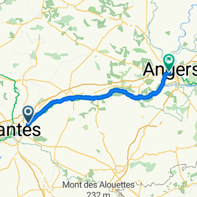
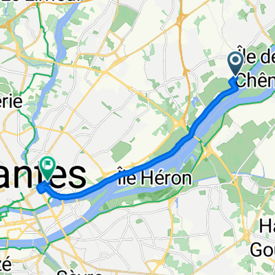
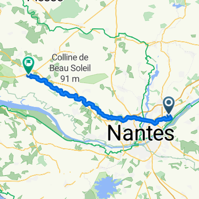
The campsite in Nantes is right by the banks of the Loire, and the cycling route pleasantly runs behind the campsite fence. We pedal upstream, and cross to the south bank of the Loire at Mauves. The route goes along quiet, asphalted field roads until just before Champtoceaux where we have to get onto the road. There is a one kilometer-long hill to Champtoceaux which can be tackled in first gear, but the view from the village to the river valley is worth the effort. Back to the northern bank of the river and Ancenis, where we turn back.
The return trip is made entirely along the northern bank of the river. The bike path stretches long distances between the railway and the narrow embankment by the river, but it is mostly in good condition, though sometimes it may be a narrow sandy path. The Loire flows at quite a shallow depth, and there are many sand islands. Is there any utility traffic at all?
A really warm and sunny day!
- -:--
- Duration
- 63.5 km
- Distance
- 151 m
- Ascent
- 153 m
- Descent
- ---
- Avg. speed
- ---
- Max. altitude

Route quality
Waytypes & surfaces along the route
Waytypes
Quiet road
20.3 km
(32 %)
Track
14 km
(22 %)
Surfaces
Paved
38.1 km
(60 %)
Unpaved
17.1 km
(27 %)
Asphalt
37.5 km
(59 %)
Gravel
10.8 km
(17 %)
Continue with Bikemap
Use, edit, or download this cycling route
You would like to ride St Luce-Ancenis or customize it for your own trip? Here is what you can do with this Bikemap route:
Free features
- Save this route as favorite or in collections
- Copy & plan your own version of this route
- Sync your route with Garmin or Wahoo
Premium features
Free trial for 3 days, or one-time payment. More about Bikemap Premium.
- Navigate this route on iOS & Android
- Export a GPX / KML file of this route
- Create your custom printout (try it for free)
- Download this route for offline navigation
Discover more Premium features.
Get Bikemap PremiumFrom our community
Other popular routes starting in Thouaré-sur-Loire
 5 giugno
- Distance
- 87.7 km
- Ascent
- 342 m
- Descent
- 330 m
- Location
- Thouaré-sur-Loire, Pays de la Loire Region, France
 Etapa 018C (Nantes - Gennes)
- Distance
- 139.6 km
- Ascent
- 498 m
- Descent
- 475 m
- Location
- Thouaré-sur-Loire, Pays de la Loire Region, France
 Tag10 Tour 2020 Sainte Luce sur Loire nach Nantes Bahnhof
- Distance
- 9.9 km
- Ascent
- 11 m
- Descent
- 8 m
- Location
- Thouaré-sur-Loire, Pays de la Loire Region, France
 Thouaré-sur-Loire à 51 Le Clairvoyant, Mauges-sur-Loire
- Distance
- 54.3 km
- Ascent
- 118 m
- Descent
- 110 m
- Location
- Thouaré-sur-Loire, Pays de la Loire Region, France
 St Luce-Ancenis
- Distance
- 63.5 km
- Ascent
- 151 m
- Descent
- 153 m
- Location
- Thouaré-sur-Loire, Pays de la Loire Region, France
 From Thouaré-sur-Loire to Savenay
- Distance
- 53.3 km
- Ascent
- 325 m
- Descent
- 302 m
- Location
- Thouaré-sur-Loire, Pays de la Loire Region, France
 De Chemin du Parc 2, Thouaré-sur-Loire à Chemin du Parc 2, Thouaré-sur-Loire
- Distance
- 30.7 km
- Ascent
- 677 m
- Descent
- 677 m
- Location
- Thouaré-sur-Loire, Pays de la Loire Region, France
 24.6. Nantes
- Distance
- 34.2 km
- Ascent
- 84 m
- Descent
- 83 m
- Location
- Thouaré-sur-Loire, Pays de la Loire Region, France
Open it in the app