

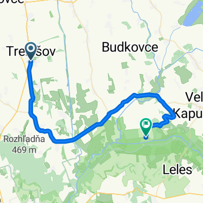
Trebišov - Kuzmice - Brezina - Jazero Izra
A cycling route starting in Trebišov, Košice Region, Slovakia.
Overview
About this route
Asfalt - cesty, polne / lesne cesty
- 2 h 2 min
- Duration
- 29 km
- Distance
- 493 m
- Ascent
- 152 m
- Descent
- 14.2 km/h
- Avg. speed
- 446 m
- Max. altitude

Continue with Bikemap
Use, edit, or download this cycling route
You would like to ride Trebišov - Kuzmice - Brezina - Jazero Izra or customize it for your own trip? Here is what you can do with this Bikemap route:
Free features
- Save this route as favorite or in collections
- Copy & plan your own version of this route
- Sync your route with Garmin or Wahoo
Premium features
Free trial for 3 days, or one-time payment. More about Bikemap Premium.
- Navigate this route on iOS & Android
- Export a GPX / KML file of this route
- Create your custom printout (try it for free)
- Download this route for offline navigation
Discover more Premium features.
Get Bikemap PremiumFrom our community
Other popular routes starting in Trebišov
 161,0 km Čierna nad Tisou- Satorajuhely
- Distance
- 159.8 km
- Ascent
- 245 m
- Descent
- 248 m
- Location
- Trebišov, Košice Region, Slovakia
 Pustafalu izra
- Distance
- 24.3 km
- Ascent
- 571 m
- Descent
- 593 m
- Location
- Trebišov, Košice Region, Slovakia
 92,0 km- Sarospatak a späť
- Distance
- 90.7 km
- Ascent
- 226 m
- Descent
- 229 m
- Location
- Trebišov, Košice Region, Slovakia
 Ukrajina 25.7.2010
- Distance
- 27.4 km
- Ascent
- 27 m
- Descent
- 35 m
- Location
- Trebišov, Košice Region, Slovakia
 TV- Kožuchov- Novosad- Oborín- Čičarovce (NCH)
- Distance
- 45.1 km
- Ascent
- 41 m
- Descent
- 46 m
- Location
- Trebišov, Košice Region, Slovakia
 Bringahorda 2015 2. nap
- Distance
- 40.6 km
- Ascent
- 433 m
- Descent
- 548 m
- Location
- Trebišov, Košice Region, Slovakia
 2010 - Cyklodovolená
- Distance
- 543.5 km
- Ascent
- 5,542 m
- Descent
- 5,456 m
- Location
- Trebišov, Košice Region, Slovakia
 Velka trna - Palhaza - Kokapu - RudaBanyacska - Karolov dvor - Velka trna
- Distance
- 59.6 km
- Ascent
- 940 m
- Descent
- 941 m
- Location
- Trebišov, Košice Region, Slovakia
Open it in the app