

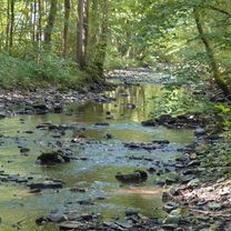
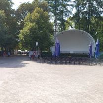
Höhenroute Horn-Bad Meinberg
A cycling route starting in Horn, North Rhine-Westphalia, Germany.
Overview
About this route
- 1 h 48 min
- Duration
- 25.7 km
- Distance
- 640 m
- Ascent
- 640 m
- Descent
- 14.3 km/h
- Avg. speed
- 433 m
- Max. altitude

Route quality
Waytypes & surfaces along the route
Waytypes
Track
12.8 km
(50 %)
Road
6.2 km
(24 %)
Surfaces
Paved
14.4 km
(56 %)
Unpaved
10 km
(39 %)
Asphalt
14.4 km
(56 %)
Gravel
10 km
(39 %)
Undefined
1.3 km
(5 %)
Continue with Bikemap
Use, edit, or download this cycling route
You would like to ride Höhenroute Horn-Bad Meinberg or customize it for your own trip? Here is what you can do with this Bikemap route:
Free features
- Save this route as favorite or in collections
- Copy & plan your own version of this route
- Sync your route with Garmin or Wahoo
Premium features
Free trial for 3 days, or one-time payment. More about Bikemap Premium.
- Navigate this route on iOS & Android
- Export a GPX / KML file of this route
- Create your custom printout (try it for free)
- Download this route for offline navigation
Discover more Premium features.
Get Bikemap PremiumFrom our community
Other popular routes starting in Horn
 Dillenkamp nach Nordstraße
- Distance
- 31.3 km
- Ascent
- 563 m
- Descent
- 608 m
- Location
- Horn, North Rhine-Westphalia, Germany
 Externsteine bis Xantener Südsee
- Distance
- 315.6 km
- Ascent
- 1,017 m
- Descent
- 1,250 m
- Location
- Horn, North Rhine-Westphalia, Germany
 Radtour durch's südöstliche Lipperland
- Distance
- 77.2 km
- Ascent
- 435 m
- Descent
- 435 m
- Location
- Horn, North Rhine-Westphalia, Germany
 Eggeweg komplett nach Garmin Topo Deutschland
- Distance
- 71.6 km
- Ascent
- 916 m
- Descent
- 800 m
- Location
- Horn, North Rhine-Westphalia, Germany
 Höhenroute Horn-Bad Meinberg
- Distance
- 25.7 km
- Ascent
- 640 m
- Descent
- 640 m
- Location
- Horn, North Rhine-Westphalia, Germany
 Externsteine - Hermannsdenkmal - Detmold - Bad Meinberg - Horn
- Distance
- 40.3 km
- Ascent
- 629 m
- Descent
- 708 m
- Location
- Horn, North Rhine-Westphalia, Germany
 Wandern Eggeweg Etappe 01
- Distance
- 25.2 km
- Ascent
- 431 m
- Descent
- 487 m
- Location
- Horn, North Rhine-Westphalia, Germany
 Etappe 11 Zoo Tour 2017
- Distance
- 46.3 km
- Ascent
- 527 m
- Descent
- 643 m
- Location
- Horn, North Rhine-Westphalia, Germany
Open it in the app