
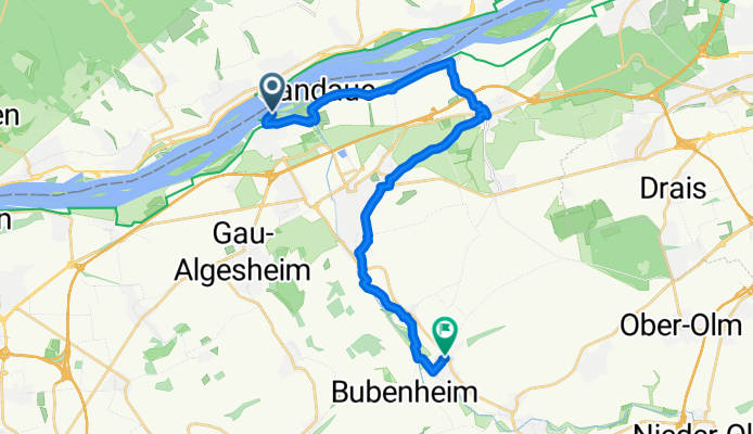
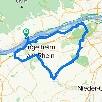
Ingelheim am Rhein nach Ingelheimer Straße, Schwabenheim an der Selz
A cycling route starting in Oestrich-Winkel, Rhineland-Palatinate, Germany.
Overview
About this route
- 1 h 14 min
- Duration
- 21 km
- Distance
- 169 m
- Ascent
- 120 m
- Descent
- 17 km/h
- Avg. speed
- 164 m
- Max. altitude
Route quality
Waytypes & surfaces along the route
Waytypes
Track
10.7 km
(51 %)
Quiet road
6.5 km
(31 %)
Surfaces
Paved
15.3 km
(73 %)
Unpaved
0.8 km
(4 %)
Asphalt
15.1 km
(72 %)
Gravel
0.8 km
(4 %)
Continue with Bikemap
Use, edit, or download this cycling route
You would like to ride Ingelheim am Rhein nach Ingelheimer Straße, Schwabenheim an der Selz or customize it for your own trip? Here is what you can do with this Bikemap route:
Free features
- Save this route as favorite or in collections
- Copy & plan your own version of this route
- Sync your route with Garmin or Wahoo
Premium features
Free trial for 3 days, or one-time payment. More about Bikemap Premium.
- Navigate this route on iOS & Android
- Export a GPX / KML file of this route
- Create your custom printout (try it for free)
- Download this route for offline navigation
Discover more Premium features.
Get Bikemap PremiumFrom our community
Other popular routes starting in Oestrich-Winkel
 Mittelheim, 7 Wegweiser, Kalte Herberge, Hallgartner Zange, Mittelheim
- Distance
- 21.1 km
- Ascent
- 535 m
- Descent
- 535 m
- Location
- Oestrich-Winkel, Rhineland-Palatinate, Germany
 Vordertaunus-Wispertal
- Distance
- 57.3 km
- Ascent
- 735 m
- Descent
- 735 m
- Location
- Oestrich-Winkel, Rhineland-Palatinate, Germany
 Rheingau retour
- Distance
- 17.9 km
- Ascent
- 55 m
- Descent
- 72 m
- Location
- Oestrich-Winkel, Rhineland-Palatinate, Germany
 Sonntagsrunde mit Kathrin
- Distance
- 20.3 km
- Ascent
- 300 m
- Descent
- 300 m
- Location
- Oestrich-Winkel, Rhineland-Palatinate, Germany
 Ingelheim am Rhein nach Ingelheimer Straße, Schwabenheim an der Selz
- Distance
- 21 km
- Ascent
- 169 m
- Descent
- 120 m
- Location
- Oestrich-Winkel, Rhineland-Palatinate, Germany
 Route zu Kloster Johannisberg
- Distance
- 28.6 km
- Ascent
- 364 m
- Descent
- 364 m
- Location
- Oestrich-Winkel, Rhineland-Palatinate, Germany
 Route in Geisenheim
- Distance
- 34.4 km
- Ascent
- 502 m
- Descent
- 502 m
- Location
- Oestrich-Winkel, Rhineland-Palatinate, Germany
 Mittelheim_Lenneberg_Schwabenheim
- Distance
- 48.8 km
- Ascent
- 184 m
- Descent
- 187 m
- Location
- Oestrich-Winkel, Rhineland-Palatinate, Germany
Open it in the app