

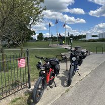
McNamara - Galena
A cycling route starting in Westerville, Ohio, United States.
Overview
About this route
- 19 min
- Duration
- 5.5 km
- Distance
- 19 m
- Ascent
- 28 m
- Descent
- 18 km/h
- Avg. speed
- 297 m
- Max. altitude

Route quality
Waytypes & surfaces along the route
Waytypes
Cycleway
4.6 km
(83 %)
Busy road
0.4 km
(8 %)
Surfaces
Paved
3.3 km
(60 %)
Asphalt
3.3 km
(60 %)
Undefined
2.2 km
(40 %)
Continue with Bikemap
Use, edit, or download this cycling route
You would like to ride McNamara - Galena or customize it for your own trip? Here is what you can do with this Bikemap route:
Free features
- Save this route as favorite or in collections
- Copy & plan your own version of this route
- Sync your route with Garmin or Wahoo
Premium features
Free trial for 3 days, or one-time payment. More about Bikemap Premium.
- Navigate this route on iOS & Android
- Export a GPX / KML file of this route
- Create your custom printout (try it for free)
- Download this route for offline navigation
Discover more Premium features.
Get Bikemap PremiumFrom our community
Other popular routes starting in Westerville
 scott route
- Distance
- 96.3 km
- Ascent
- 233 m
- Descent
- 203 m
- Location
- Westerville, Ohio, United States
 McNamara - Galena
- Distance
- 5.5 km
- Ascent
- 19 m
- Descent
- 28 m
- Location
- Westerville, Ohio, United States
 From home to Galena Ohio
- Distance
- 7.3 km
- Ascent
- 31 m
- Descent
- 14 m
- Location
- Westerville, Ohio, United States
 day 4 otet - Westerville to cedarville
- Distance
- 112.8 km
- Ascent
- 352 m
- Descent
- 285 m
- Location
- Westerville, Ohio, United States
 Westerville Bikes n Brews Tour Part II
- Distance
- 12.8 km
- Ascent
- 49 m
- Descent
- 46 m
- Location
- Westerville, Ohio, United States
 Westerville Bikes N Brews Tour
- Distance
- 13.8 km
- Ascent
- 50 m
- Descent
- 51 m
- Location
- Westerville, Ohio, United States
 Alum Creek Trail
- Distance
- 22.4 km
- Ascent
- 31 m
- Descent
- 46 m
- Location
- Westerville, Ohio, United States
 Alum Creek One Way
- Distance
- 30.7 km
- Ascent
- 33 m
- Descent
- 51 m
- Location
- Westerville, Ohio, United States
Open it in the app