

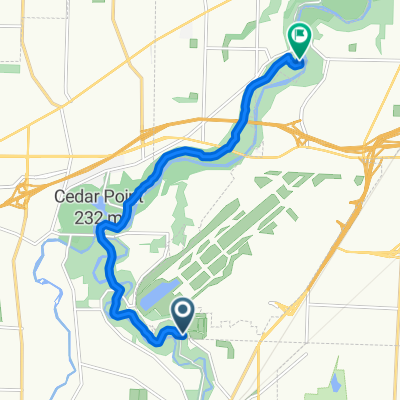
From Berea to Cleveland
A cycling route starting in Berea, Ohio, United States.
Overview
About this route
- 1 h 12 min
- Duration
- 21 km
- Distance
- 164 m
- Ascent
- 175 m
- Descent
- 17.4 km/h
- Avg. speed
- 245 m
- Max. altitude
Route quality
Waytypes & surfaces along the route
Waytypes
Cycleway
15.8 km
(75 %)
Quiet road
3.6 km
(17 %)
Surfaces
Paved
19.3 km
(92 %)
Asphalt
19.1 km
(91 %)
Paved (undefined)
0.1 km
(<1 %)
Continue with Bikemap
Use, edit, or download this cycling route
You would like to ride From Berea to Cleveland or customize it for your own trip? Here is what you can do with this Bikemap route:
Free features
- Save this route as favorite or in collections
- Copy & plan your own version of this route
- Sync your route with Garmin or Wahoo
Premium features
Free trial for 3 days, or one-time payment. More about Bikemap Premium.
- Navigate this route on iOS & Android
- Export a GPX / KML file of this route
- Create your custom printout (try it for free)
- Download this route for offline navigation
Discover more Premium features.
Get Bikemap PremiumFrom our community
Other popular routes starting in Berea
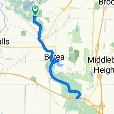
 Emerald Necklace Trail, Berea to Cleveland Metro Park Dr, Berea
- Distance
- 23.2 km
- Ascent
- 90 m
- Descent
- 90 m
- Location
- Berea, Ohio, United States
 Emerald Necklace Trail, Berea to 327 Prospect St, Berea
- Distance
- 11.9 km
- Ascent
- 31 m
- Descent
- 55 m
- Location
- Berea, Ohio, United States
 Recovered Route
- Distance
- 10.9 km
- Ascent
- 54 m
- Descent
- 57 m
- Location
- Berea, Ohio, United States
 From Berea to Cleveland
- Distance
- 21 km
- Ascent
- 164 m
- Descent
- 175 m
- Location
- Berea, Ohio, United States
 ms 75
ms 75- Distance
- 120.6 km
- Ascent
- 305 m
- Descent
- 365 m
- Location
- Berea, Ohio, United States
 Route to South Mastick Picnic Area
- Distance
- 9 km
- Ascent
- 61 m
- Descent
- 83 m
- Location
- Berea, Ohio, United States
 551 Cranston Cir, Berea to 121 N La Salle St, Chicago
- Distance
- 585.5 km
- Ascent
- 313 m
- Descent
- 329 m
- Location
- Berea, Ohio, United States
 3) MetroPark Willow Bend Picnic Area, Valley Parkway, Brook Park to Walter F Ehrnfelt Covered Bridge historic landmark at Whitney Rd, Strongsville
- Distance
- 16.8 km
- Ascent
- 86 m
- Descent
- 89 m
- Location
- Berea, Ohio, United States
Open it in the app