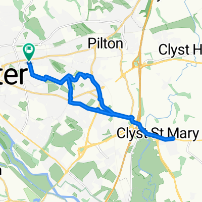
Babbage Way, Exeter to Babbage Way, Exeter
A cycling route starting in Heavitree, England, United Kingdom.
Overview
About this route
- 1 h 54 min
- Duration
- 34.5 km
- Distance
- 489 m
- Ascent
- 493 m
- Descent
- 18.1 km/h
- Avg. speed
- 180 m
- Max. altitude
Route quality
Waytypes & surfaces along the route
Waytypes
Quiet road
13.4 km
(39 %)
Busy road
11.1 km
(32 %)
Surfaces
Paved
19.9 km
(58 %)
Asphalt
19 km
(55 %)
Paved (undefined)
0.9 km
(3 %)
Undefined
14.6 km
(42 %)
Continue with Bikemap
Use, edit, or download this cycling route
You would like to ride Babbage Way, Exeter to Babbage Way, Exeter or customize it for your own trip? Here is what you can do with this Bikemap route:
Free features
- Save this route as favorite or in collections
- Copy & plan your own version of this route
- Sync your route with Garmin or Wahoo
Premium features
Free trial for 3 days, or one-time payment. More about Bikemap Premium.
- Navigate this route on iOS & Android
- Export a GPX / KML file of this route
- Create your custom printout (try it for free)
- Download this route for offline navigation
Discover more Premium features.
Get Bikemap PremiumFrom our community
Other popular routes starting in Heavitree
- Babbage Way, Exeter to Babbage Way, Exeter
- Distance
- 44.3 km
- Ascent
- 573 m
- Descent
- 572 m
- Location
- Heavitree, England, United Kingdom
- Cranbrook to Budleigh Salterton
- Distance
- 19.5 km
- Ascent
- 214 m
- Descent
- 216 m
- Location
- Heavitree, England, United Kingdom
- exeter to budleigh salterton, exeter33.2 mls
- Distance
- 53.2 km
- Ascent
- 343 m
- Descent
- 340 m
- Location
- Heavitree, England, United Kingdom
- teignmouth- moretonhampstead
- Distance
- 109.8 km
- Ascent
- 661 m
- Descent
- 656 m
- Location
- Heavitree, England, United Kingdom
- Babbage Way, Exeter to Babbage Way, Exeter
- Distance
- 34.5 km
- Ascent
- 489 m
- Descent
- 493 m
- Location
- Heavitree, England, United Kingdom
- Mamhead Training Run
- Distance
- 36 km
- Ascent
- 482 m
- Descent
- 493 m
- Location
- Heavitree, England, United Kingdom
- Stoke Hill Loop
- Distance
- 13.1 km
- Ascent
- 214 m
- Descent
- 214 m
- Location
- Heavitree, England, United Kingdom
- A circular ride past Steps Bridge and the Reservoirs
- Distance
- 68.6 km
- Ascent
- 843 m
- Descent
- 819 m
- Location
- Heavitree, England, United Kingdom
Open it in the app