

Grenchenberg-Weissenstein
A cycling route starting in Solothurn, Canton of Solothurn, Switzerland.
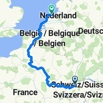
Overview
About this route
- 7 h 5 min
- Duration
- 114.4 km
- Distance
- 2,976 m
- Ascent
- 3,063 m
- Descent
- 16.2 km/h
- Avg. speed
- 1,362 m
- Max. altitude
Route quality
Waytypes & surfaces along the route
Waytypes
Quiet road
46.7 km
(41 %)
Road
31.1 km
(27 %)
Surfaces
Paved
76.5 km
(67 %)
Unpaved
1.1 km
(<1 %)
Asphalt
74.2 km
(65 %)
Paved (undefined)
2.3 km
(2 %)
Continue with Bikemap
Use, edit, or download this cycling route
You would like to ride Grenchenberg-Weissenstein or customize it for your own trip? Here is what you can do with this Bikemap route:
Free features
- Save this route as favorite or in collections
- Copy & plan your own version of this route
- Split it into stages to create a multi-day tour
- Sync your route with Garmin or Wahoo
Premium features
Free trial for 3 days, or one-time payment. More about Bikemap Premium.
- Navigate this route on iOS & Android
- Export a GPX / KML file of this route
- Create your custom printout (try it for free)
- Download this route for offline navigation
Discover more Premium features.
Get Bikemap PremiumFrom our community
Other popular routes starting in Solothurn
 Solothurn - Küsnacht
- Distance
- 114 km
- Ascent
- 549 m
- Descent
- 566 m
- Location
- Solothurn, Canton of Solothurn, Switzerland
 Von Solothurn bis Hägendorf
- Distance
- 197.9 km
- Ascent
- 1,142 m
- Descent
- 1,211 m
- Location
- Solothurn, Canton of Solothurn, Switzerland
 Solothurn - Bucheggberg - Solothurn
- Distance
- 50 km
- Ascent
- 249 m
- Descent
- 244 m
- Location
- Solothurn, Canton of Solothurn, Switzerland
 Grenchenberg-Weissenstein
- Distance
- 114.4 km
- Ascent
- 2,976 m
- Descent
- 3,063 m
- Location
- Solothurn, Canton of Solothurn, Switzerland
 Feierabendtour Richtung Balmberg
- Distance
- 19.4 km
- Ascent
- 1,025 m
- Descent
- 1,013 m
- Location
- Solothurn, Canton of Solothurn, Switzerland
 Moll-Treff 2025
- Distance
- 10.2 km
- Ascent
- 23 m
- Descent
- 23 m
- Location
- Solothurn, Canton of Solothurn, Switzerland
 Vorschlag Paris Amsti
- Distance
- 1,376.1 km
- Ascent
- 8,340 m
- Descent
- 8,776 m
- Location
- Solothurn, Canton of Solothurn, Switzerland
 Vorberg, Weissenstein
- Distance
- 20.6 km
- Ascent
- 555 m
- Descent
- 551 m
- Location
- Solothurn, Canton of Solothurn, Switzerland
Open it in the app