


Zum "Frau Holle Teich" und zurück.
A cycling route starting in Borken, Hesse, Germany.
Overview
About this route
0
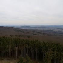
Very nice route for the road bike. Our destination is the 'Frau Holle Teich' on the Hohen Meißner. Here, we face the steepest ascent on the route, needing to overcome about 350 meters of elevation over a length of 4.6 kilometers. The last 20 kilometers are relatively flat towards the end - ideal for rolling out.
- -:--
- Duration
- 142.9 km
- Distance
- 1,407 m
- Ascent
- 1,407 m
- Descent
- ---
- Avg. speed
- ---
- Max. altitude
ricard77
created this 14 years ago
Route quality
Waytypes & surfaces along the route
Waytypes
Road
15.7 km
11 %
Quiet road
7.1 km
5 %
Surfaces
Paved
118.6 km
(83 %)
Unpaved
2.9 km
(2 %)
Asphalt
117.2 km
82 %
Paved (undefined)
1.4 km
1 %
Continue with Bikemap
Use, edit, or download this cycling route
You would like to ride Zum "Frau Holle Teich" und zurück. or customize it for your own trip? Here is what you can do with this Bikemap route:
Free features
- Save this route as favorite or in collections
- Copy & plan your own version of this route
- Split it into stages to create a multi-day tour
- Sync your route with Garmin or Wahoo
Premium features
Free trial for 3 days, or one-time payment. More about Bikemap Premium.
- Navigate this route on iOS & Android
- Export a GPX / KML file of this route
- Create your custom printout (try it for free)
- Download this route for offline navigation
Discover more Premium features.
Get Bikemap PremiumFrom our community
Other popular routes starting in Borken


Open it in the app