

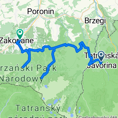
Ždiar-Pri Tablici- Magurka- Slodič.vrch- M.Poľana
A cycling route starting in Ždiar, Prešov Region, Slovakia.
Overview
About this route
Asphalt - roads, full / forest roads
- 1 h 18 min
- Duration
- 17.9 km
- Distance
- 435 m
- Ascent
- 438 m
- Descent
- 13.8 km/h
- Avg. speed
- 1,197 m
- Max. altitude

Continue with Bikemap
Use, edit, or download this cycling route
You would like to ride Ždiar-Pri Tablici- Magurka- Slodič.vrch- M.Poľana or customize it for your own trip? Here is what you can do with this Bikemap route:
Free features
- Save this route as favorite or in collections
- Copy & plan your own version of this route
- Sync your route with Garmin or Wahoo
Premium features
Free trial for 3 days, or one-time payment. More about Bikemap Premium.
- Navigate this route on iOS & Android
- Export a GPX / KML file of this route
- Create your custom printout (try it for free)
- Download this route for offline navigation
Discover more Premium features.
Get Bikemap PremiumFrom our community
Other popular routes starting in Ždiar
 Nach Lapszanka
- Distance
- 43.6 km
- Ascent
- 637 m
- Descent
- 637 m
- Location
- Ždiar, Prešov Region, Slovakia
 Velo Dunajec p.2
- Distance
- 111.3 km
- Ascent
- 2,129 m
- Descent
- 2,383 m
- Location
- Ždiar, Prešov Region, Slovakia
 D4_Górskie małe co nieco
- Distance
- 43.9 km
- Ascent
- 1,354 m
- Descent
- 1,508 m
- Location
- Ždiar, Prešov Region, Slovakia
 Ždiar-Pri Tablici- Magurka- Slodič.vrch- M.Poľana
- Distance
- 17.9 km
- Ascent
- 435 m
- Descent
- 438 m
- Location
- Ždiar, Prešov Region, Slovakia
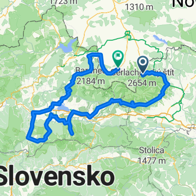 Cycling Tour around the High Tatras
- Distance
- 271.1 km
- Ascent
- 2,226 m
- Descent
- 2,432 m
- Location
- Ždiar, Prešov Region, Slovakia
 Ždiar, Ždiar to Ždiar, Ždiar
- Distance
- 47.1 km
- Ascent
- 1,405 m
- Descent
- 1,325 m
- Location
- Ždiar, Prešov Region, Slovakia
 Ždiar-Osturňa- V.Franková- Niedzica-Zamek (PL)
- Distance
- 21.8 km
- Ascent
- 384 m
- Descent
- 705 m
- Location
- Ždiar, Prešov Region, Slovakia
 Recovered Route
- Distance
- 25.9 km
- Ascent
- 264 m
- Descent
- 824 m
- Location
- Ždiar, Prešov Region, Slovakia
Open it in the app