

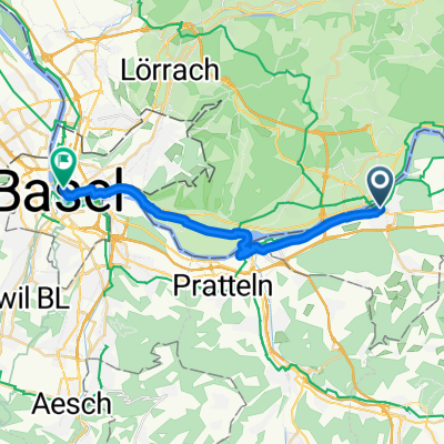
Schwarzwald 24.06.2012
A cycling route starting in Rheinfelden, Canton of Aargau, Switzerland.
Overview
About this route
- -:--
- Duration
- 53.4 km
- Distance
- 650 m
- Ascent
- 650 m
- Descent
- ---
- Avg. speed
- ---
- Max. altitude

Route quality
Waytypes & surfaces along the route
Waytypes
Quiet road
13.9 km
(26 %)
Access road
4.3 km
(8 %)
Surfaces
Paved
48.6 km
(91 %)
Unpaved
0.5 km
(1 %)
Asphalt
44.3 km
(83 %)
Paved (undefined)
2.1 km
(4 %)
Continue with Bikemap
Use, edit, or download this cycling route
You would like to ride Schwarzwald 24.06.2012 or customize it for your own trip? Here is what you can do with this Bikemap route:
Free features
- Save this route as favorite or in collections
- Copy & plan your own version of this route
- Sync your route with Garmin or Wahoo
Premium features
Free trial for 3 days, or one-time payment. More about Bikemap Premium.
- Navigate this route on iOS & Android
- Export a GPX / KML file of this route
- Create your custom printout (try it for free)
- Download this route for offline navigation
Discover more Premium features.
Get Bikemap PremiumFrom our community
Other popular routes starting in Rheinfelden
 Von Rheinfelden (Baden) bis Kandern
- Distance
- 29.5 km
- Ascent
- 610 m
- Descent
- 546 m
- Location
- Rheinfelden, Canton of Aargau, Switzerland
 Rund um Basel
- Distance
- 76.1 km
- Ascent
- 481 m
- Descent
- 499 m
- Location
- Rheinfelden, Canton of Aargau, Switzerland
 Schwarzwald 24.06.2012
- Distance
- 53.4 km
- Ascent
- 650 m
- Descent
- 650 m
- Location
- Rheinfelden, Canton of Aargau, Switzerland
 Von Rheinfelden (Baden) bis Todtnau
- Distance
- 60.7 km
- Ascent
- 1,044 m
- Descent
- 677 m
- Location
- Rheinfelden, Canton of Aargau, Switzerland
 Rund um die Schweiz - Etappe 2
- Distance
- 67 km
- Ascent
- 489 m
- Descent
- 250 m
- Location
- Rheinfelden, Canton of Aargau, Switzerland
 Marktgasse nach Webergasse
- Distance
- 20 km
- Ascent
- 88 m
- Descent
- 110 m
- Location
- Rheinfelden, Canton of Aargau, Switzerland
 Waldshut / Koblenz
- Distance
- 83.5 km
- Ascent
- 291 m
- Descent
- 291 m
- Location
- Rheinfelden, Canton of Aargau, Switzerland
 Von Rheinfelden bis Kandern
- Distance
- 30.8 km
- Ascent
- 616 m
- Descent
- 551 m
- Location
- Rheinfelden, Canton of Aargau, Switzerland
Open it in the app